Analysis and processing of images of geoinformation systems

Author: Nabiyeva I.S., Nabiyeva S.S.
Journal: Форум молодых ученых @forum-nauka
Article in issue: 12 (16), 2017.
Free access
The paper describes the software results of image compressing method RLE to accelerate of geoinformation systems to analyse and processing image data.
Short address: https://sciup.org/140277697
IDR: 140277697
Анализ и обработка изображений геоинформационных систем
В статье описаны результаты программного обеспечения метода сжатия изображений RLE для ускорения геоинформационных систем для анализа и обработки данных изображения.
Text of the scientific article Analysis and processing of images of geoinformation systems
Images obtained with the help of space resources play an exceptionally important role in scientific research, industrial, economic, military and other applications of geoinformation technologies. It should be noted that, the acquisition of space images is associated with serious technological difficulties, during the conversion of an optical signal into digital data, it is influenced by distorting factors that must be taken into account and compensated as much as possible. Images of the Earth, obtained from space, in themselves are very specific information objects, the processing of which requires the use of special mathematical methods and computational algorithms [1]. The sequence of distorting factors and transformations to which an optical signal is subjected on the way from its source to the receiver of information is usually called the "video information path" of the imaging system. Video sensors convert the image into an electrical signal and then, after an analog-to-digital conversion, into a matrix.
Before transmitting to the ground receiving point, a special type of image processing is performed directly on board the spacecraft - compression, which allows to reduce their volume many times without losing the quality of the data. Compressed images are then transmitted to Earth via a digital data channel for processing and accumulation (storage). Ground processing of the received space images is usually divided into preliminary (primary), and final (thematic). Preprocessing includes image restoration from compressed data, compensation of distortions made in the video information path, brightness and geometric correction, etc. Pre-processing is completed by the formation of the so-called basic information products (BIP) - normalized frames of digital images intended for multi-purpose use in the future. Thematic processing of images is carried out in the interests of solving specific applied problems. And the "raw" data transmitted from the spacecraft and the BIP, and the results of the thematic processing can be placed in a specialized database - the image storage complex. The development of appropriate modeling software is an independent, very difficult scientific and technical task, especially if one takes into account that each link in the video information path can have a very complex internal structure. Image compression. Among the various types of processing of space images, compression (compression) is of paramount importance; processing in order to reduce the amount of data. The specificity of the task of compression of space images in real time also generates specific requirements for algorithms and information compression technologies that differ from those that are usually applied to similar algorithms in traditional digital photography and other computer applications: strict quality control of the images (restored after compression) compression ratio, stabilization of the output data rate, noise immunity of the compressed data, low computational speed I and structural complexity with software and hardware implementation. A method for image compression based on the length-series coding (RLE method) has been developed, which, as it turned out, after a slight modification can meet all of the above requirements. The main idea of the RLE method is to replace the repeating characters (series) by one character and the number of its repeats in the matrix image. A series is a sequence consisting of several identical symbols. When encoding (packing, compressing) a string of identical symbols constituting a series is replaced by a string containing the repeating symbol itself and the number of its repetitions.
The algorithms that implement the RLE method have several times less computational complexity than other compression methods, comparable to it in quality. In addition, simple procedures are easy to integrate into the RLE method, providing additional compression requirements specific to remote sensing systems.
-
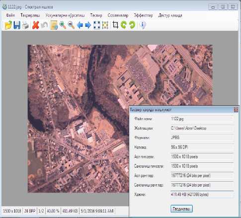
a) snap shot b) snapshot after processing
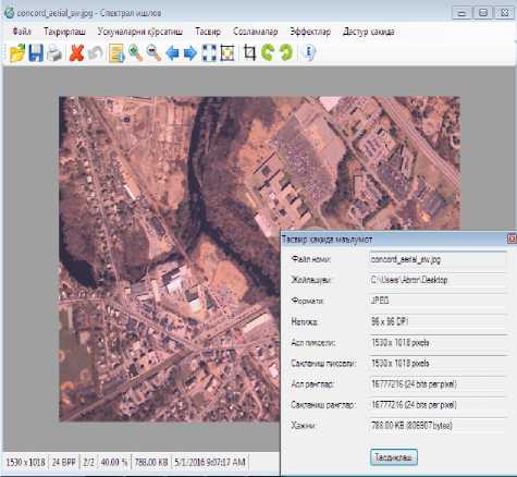
Picture 1. Window of the program for processing the picture.
References Analysis and processing of images of geoinformation systems
- Sergeev V.V. Analysis and processing of images obtained by observing the earth from space. Computer optics. Issue number 29. 2006
- Methods of computer image processing, Ed. V.A. Soifer. Moscow: Fizmatlit, 2003. 784 p.
