
Current Environmental Condition of Floodplain Soils in Shahdag National Park, Azerbaijan
Журнал: Бюллетень науки и практики @bulletennauki
Рубрика: Естественные науки
Статья в выпуске: 10 т.12, 2026 года.
Бесплатный доступ
Soil-forming processes in floodplains occur under specific conditions. The floodplain area is periodically flooded, which contributes to a rise in groundwater, affects the direction and intensity of microbiological processes in the soil, and influences the type of natural vegetation and its productivity, as well as the salinity regime of soils and groundwater. Repeated disruptions in the soil formation rhythm are reflected in the morphology and properties of floodplain soils. The article examines the current state of the soil cover in Shahdag National Park, the largest nature conservation area in Azerbaijan. It provides a bio-ecological characterization of the alluvial-meadow and alluvial-meadow-forest soils found in the area and presents soil fertility indicators such as humus content, total nitrogen, and soil reaction (pH).
Короткий адрес: https://sciup.org/14139238
IDS: 14139238 | УДК: 574:631.4 | DOI: 10.33619/2414-2948/131/07
Современное экологическое состояние пойменных почв Шахдагского национального парка (Азербайджан)
Почвообразующие процессы в поймах рек протекают в особых условиях. Территория поймы периодически затапливается, что способствует подъему уровня грунтовых вод, влияет на направление и интенсивность микробиологических процессов в почве, а также на тип естественной растительности и ее продуктивность, а также на режим засоления почв и грунтовых вод. Повторяющиеся нарушения ритма почвообразования отражаются на морфологии и свойствах пойменных почв. В статье рассматривается современное состояние почвенного покрова в Шахдагском национальном парке, крупнейшей природоохранной зоне Азербайджана. В нем дается биоэкологическая характеристика аллювиально-луговых и аллювиально-лугово-лесных почв, распространенных в этом районе, и представлены показатели плодородия почв, такие как содержание гумуса, общего содержания азота и реакция почвы (pH).
Текст научной статьи Current Environmental Condition of Floodplain Soils in Shahdag National Park, Azerbaijan
Бюллетень науки и практики / Bulletin of Science and Practice
UDC 574: 631.4
Studying Earth's natural systems and the characteristics of their transformation under the influence of various factors makes it possible to address issues of regional ecogeography. The mountain landscape of the Greater Caucasus region, including Shahdag National Park, is characterized by altitudinal zonation, a complex spatial structure, and dynamic development. Mountain ecosystems are fragile and highly susceptible to the impacts of climate change and ill- conceived economic activities. This results in a reduction of high-quality habitat areas and a decline in regional biodiversity. In an effort to address socio-economic challenges, the high-mountain geosystems of the Greater Caucasus have been subjected to significant anthropogenic pressure in recent decades. The application of modern technologies for effective natural resource management in mountainous areas remains insufficient, and local authorities do not always fulfill their responsibilities — factors that directly impact the region's natural landscapes.
The prevailing view remains largely one of an ecological culture characterized by inexhaustible natural resources and a minimal connection between humans and the environment. In recent years, anthropogenic pressure on the natural environment of high-mountain regions has led to numerous negative ecological consequences. Significant changes have occurred in the water balance and chemical composition of many rivers in the Greater Caucasus, while the forests within the national park have suffered greatly due to past logging and uncontrolled livestock grazing in forest clearings.
The aim of the study is to analyze and assess the current state of alluvial-meadow landscapesoil complexes in the Shahdag National Park region, identify the characteristics of their transformation resulting from human impact, and formulate measures for their rational and optimized use. Many rivers flow through the Greater Caucasus, and many of them have well-developed river valleys. Floodplain soils appear in intermittent strips under gallery tugai forests in the floodplains of rivers on the southern and northeastern slopes of the Greater Caucasus. In this area, there are two types of soils in river valleys: floodplain-meadow-forest soils and floodplain-meadow soils. In the modern soil classification of the republic, these soils are called alluvial. The term 'alluvial' emphasizes the role of alluvial processes in the formation of floodplain soils—that is, the deposition of suspended materials by floodwaters, the erosion of the floodplain, and the redeposition of water-borne particles on the surface as a layer of alluvium.
Materials and methods of the study
Covering an area of 130,508.1 hectares, Shahdag National Park is the largest national park in both Azerbaijan and the entire South Caucasus (Figure 1). The aim of establishing the park is to protect mountain forests, as well as alpine and subalpine ecosystems, conduct scientific research, monitor the environment, raise public environmental awareness, and foster the development of ecotourism in the area. The park's layout and geography encompass a vast and complex territory spanning the high and mid-mountain zones of the Greater Caucasus mountain range [1, 2].
The national park does not consist of a single, contiguous tract of land; rather, it extends across the territories of six administrative districts in the northern and northwestern regions of Azerbaijan. The park can be divided into the following regional sectors: the Northern Sector (Quba and Qusar districts)—this section encompasses the park’s highest mountainous zone. Azerbaijan’s highest peaks, Bazarduzu (4,466 m) and Shahdag (4,243 m), as well as the famous Tufandag, are located in this sector. Ancient ethnic mountain villages such as Laza (in Qusar district), Khinalig, and Griz (in Quba district), along with frozen waterfalls, are key features of this area. The Southwest sector (Qabala, Oghuz, and Ismayilli districts) encompasses the southern slopes of the Greater Caucasus range. The zone is rich in dense forest cover (primarily beech, hornbeam, and oak forests) and valleys. The basins of high-volume mountain rivers, such as the Goychay, Damiraparanchay, and Vandamchay, are located here. The Southeast sector (Shamakhi district) forms the southeastern boundaries of the park and includes the Pirgulu State Nature Sanctuary. It is characterized by a landscape of relatively lower mountains and forest-steppe terrain [11, 12].
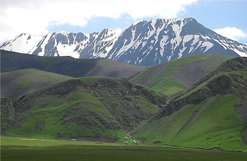
Figure 1. Shahdag National Park
The park's internal management and protection map is divided into functional zones with distinct regimes: a strict protection zone, consisting of areas of undisturbed nature where human activity is completely prohibited and only scientific research is permitted (e.g., high-mountain glacier areas); an ecotourism and recreation zone, comprising areas where tourist movement is permitted and designated trekking routes are located; and an economic activity zone, which is a transitional area surrounding the park where the local population engages in traditional agricultural activities [3, 4].
We conducted field studies to examine the soil cover of the alluvial meadows in Shahdag National Park (Figure 2). We also utilized literature sources and cartographic materials. Analyses of the collected soil samples were performed using standard methods.
Alluvial-meadow-forest soils are found in the territory of Shahdag National Park on the wide floodplain terraces of the main rivers, where there are conditions for groundwater recharge and the influence of the floodplain regime. Genetically, these soils are insufficiently studied. Even in the research materials from the 1920s–30s by S. A. Zakharov, V. P. Smirnova-Loginova, and A. N. Izyumov, floodplain-meadow-forest soils were identified as an independent type called lowland forest “tugai” soils [3, 4].
Later, hydromorphic and semi-hydromorphic soils were studied in more detail by G. A. Aliyev [5].
The term “tugai” is connected with the name of the forests (tugai), which stretch in narrow discontinuous bands along large and small rivers flowing through lowland treeless areas of Azerbaijan, including poplar ( Populus sp.), willow ( Salix sp.), pear ( Pyrus sp.), and others.
Alluvial meadow-forest soils have a distinctive morphological profile that noticeably sets them apart from soils developed outside floodplain conditions. They are characterized by sharp layering and the frequent alternation of layers with different particle sizes (sand, silt, and gravel), which is related to the lithological composition of the alluvium deposited during floods and the duration of those floods [6].
Since soils in the dry steppe zone receive almost no rainfall during the long, hot summer, processes of carbonation and sometimes even salinization of the profile can easily occur here when groundwater is close to the surface. This also applies to the soils being described. We have been studying the current state of floodplain soils in the Greater Caucasus, within the territory of Shahdag National Park, for several years [7, 8].
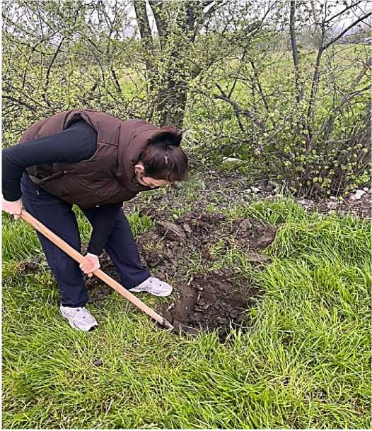
Figure 2. Fieldwork on the floodplain soils in Shahdag National Park
Results and discussion
An example of such soil can be seen in a characteristic profile laid out 400 m west of the Gudyalchay River.
O – 0–1 cm – dry litter
AUzv – 1–10 cm – gray-brown, medium loam, loose, dry, roots, clear transition, fizzes slightly A/BCagv – 10–35 cm – light gray-brown, clayey, dense, moist, layered, bluish and ochre spots, fizzes slightly
BCAg – 35–69 cm – gray-brown, medium loam, moist, bluish and ochre spots, fizzes
BC/CagI – 69–105 cm – whitish-tawny, heavy loam, moist, layered, fizzes
Within the territory of Shahdag National Park, alluvial-meadow soils form in river alluvium under the influence of surface and groundwater; these soils are found in distinct patches [9].
The grain size composition of alluvial-meadow-forest carbonate soils is mostly medium to heavy loam. In some horizons, the content of physical clay decreases to 26.42%, while in others it reaches up to 50.58%. This variety in grain size composition and the sharp layering, as mentioned above, is related to disruptions in soil formation rhythm and the lithological composition of the alluvium deposited during floods. Alluvial-meadow-forest soils contain 2.87-4.80% humus in the top layer, with a sharp drop in its content down the profile, which is typical for forest-origin soils. In the lower layers, the humus content is only 0.38-0.76%. Humus reserves in a one-meter layer are 139.10246.30 t/ha, which is close to those of mountain gray-brown soils. This soil is fairly rich in absorbed bases: 18.9-29.3 mg-eq/100 g of soil. Among the exchangeable bases, calcium predominates (Table 1).
Table 1
|
si Со |
Depth, |
Humus, |
Nitro- |
Phos- |
Potas- |
Exchangeable bases meq/100 |
ESP, |
pH |
|||
|
cm |
% |
gen, % |
phorus, |
sium, |
g of soil |
||||||
|
% |
% |
H + |
Ca++ |
Mg++ |
Na+ |
meq/100 g of soil |
|||||
|
1 |
0-23 |
3,04 |
0,22 |
0,18 |
3,42 |
- |
14,00 |
8,00 |
1,00 |
23,00 |
8,0 |
|
23-50 |
2,50 |
0,18 |
0,14 |
2,81 |
- |
22,00 |
9,90 |
0,90 |
32,80 |
8,1 |
|
|
50-83 |
1,00 |
0,10 |
0,13 |
3,08 |
- |
15,00 |
8,00 |
0,80 |
23,80 |
8,0 |
|
|
83-105 |
0,85 |
0,08 |
0,14 |
2,76 |
- |
14,50 |
7,00 |
0,90 |
22,40 |
7,9 |
|
|
105-130 |
0,44 |
0,06 |
0,11 |
3,48 |
- |
13,00 |
8,00 |
0,70 |
21,70 |
8,2 |
|
|
2 |
0-25 |
2,83 |
0,21 |
0,18 |
3,08 |
- |
16,75 |
6,50 |
0,90 |
24,15 |
8,6 |
|
25-54 |
1,47 |
0,13 |
0,12 |
2,88 |
- |
12,63 |
4,75 |
0,70 |
18,08 |
8,8 |
|
|
54-88 |
0,57 |
0,09 |
0,07 |
2,66 |
- |
11,00 |
4,50 |
0,80 |
16,30 |
8,5 |
|
|
88-104 |
0,34 |
0,07 |
0,06 |
2,62 |
- |
12,00 |
4,00 |
0,80 |
16,80 |
8,7 |
|
|
104-135 |
0,23 |
0,06 |
0,05 |
2,98 |
- |
10,50 |
3,60 |
0,70 |
14,80 |
8,4 |
|
|
3 |
0-28 |
2,99 |
0,22 |
0,20 |
2,48 |
- |
20,38 |
7,87 |
0,80 |
29,05 |
8,5 |
|
28-57 |
1,52 |
0,13 |
0,11 |
2,88 |
- |
19,88 |
5,75 |
0,60 |
26,23 |
8,7 |
|
|
57-86 |
0,42 |
0,09 |
0,06 |
2,96 |
- |
19,00 |
6,50 |
0,80 |
26,30 |
8,4 |
|
|
86-107 |
0,28 |
0,07 |
0,05 |
2,76 |
- |
17,50 |
7,00 |
0,90 |
25,40 |
8,6 |
|
|
107-140 |
0,18 |
0,06 |
0,05 |
2,58 |
- |
16,00 |
6,50 |
0,80 |
23,30 |
8,7 |
|
|
4 |
0-18 |
2,40 |
0,19 |
0,21 |
3,24 |
- |
9,37 |
8,63 |
0,70 |
18,70 |
8,5 |
|
18-37 |
1,93 |
0,16 |
0,20 |
3,00 |
- |
10,75 |
7,12 |
0,90 |
18,77 |
8,4 |
|
|
37-54 |
1,00 |
0,10 |
0,17 |
3,02 |
- |
11,87 |
4,75 |
0,80 |
17,42 |
8,7 |
|
|
54-90 |
0,41 |
0,06 |
0,07 |
3,14 |
- |
10,50 |
5,00 |
0,70 |
16,20 |
8,6 |
|
|
90-125 |
0,22 |
0,05 |
0,05 |
2,96 |
- |
9,00 |
4,50 |
0,60 |
14,10 |
8,5 |
|
PHYSICOCHEMICAL COMPOSITION OF ALLUVIAL-MEADOW FOREST SOILS
IN SHAHDAG NATIONAL PARK
Carbonates are found throughout the profile, with an average content in the 0-100 cm layer of 10.61±0.51%. Moving down the profile, the amount of carbonates increases to 11.55-13.22%. The soils are slightly alkaline or alkaline throughout the profile, ranging from 7.9 to 8.7 pH.
Because these soils develop under leaching or alternating leaching conditions, they are usually not saline.
Traces of human activity and livestock grazing can be seen everywhere in the tugai forests. Systematic browsing of young forest trees and cutting down trees for fodder have led to sparse tree cover in many parts of the tugai and have contributed to the intensive growth of thorny shrub undergrowth. Due to grazing, many types of weeds have invaded the herb layer.
Even though the floodplain soils of Shahdag National Park aren't very fertile, they are extremely important ecologically. Tugai forests mostly grow in lowland areas devoid of other forests, so wherever they still exist, they need special protection and restoration. Tugai forests play a big role in stabilizing riverbanks, protecting the soil from erosion and abrasion, and preventing reservoirs from silting up. Many of the tree and shrub species in these forests are valuable for their fruits and medicinal properties.
In the areas where these soils occur, the normal rhythm of soil formation is frequently disrupted by the inundation of the soil surface by river water (primarily during flood periods) and the duration of these inundation events. Alluvial-meadow soils develop under meadow and shrub vegetation. Abundant herbaceous vegetation plays a significant role in enriching these soils with organic matter and ash elements. Groundwater lies relatively close to the surface and is typically weakly mineralized. Modern alluvial deposits — consisting of poorly sorted sandy loam or sandy-gravelly-pebbly material — serve as the primary parent materials for these soils. The morphological structure of alluvial-meadow soils exhibits several characteristic features. Foremost among these is the presence of a sod layer in the upper part of the soil profile. Rhizomatous grasses (such as couch grass, etc.) play a primary role in the formation of this sod layer. Like alluvial meadow-forest soils, these soils are characterized by distinct stratification and highly variable granulometric composition.
PHYSICOCHEMICAL COMPOSITION OF THE ALLUVIAL-MEADOW SOILS OF SHAHDAG NATIONAL PARK
Table 2
|
Section |
Depth, cm |
Humus, % |
Nitrogen, % |
Phosphorus, % |
Potassium, % |
Exchangeable bases meq/100 g of soil |
ESP, meq/100 g of soil |
pH |
||
|
H+ Ca++ |
Mg++ |
Na+ |
||||||||
|
1 |
0-21 |
2,25 |
0,16 |
0,16 |
2,36 |
- 13,40 |
7,50 |
1,00 |
21,90 |
7,9 |
|
21-50 |
1,62 |
0,14 |
0,10 |
2,54 |
- 12,11 |
8,34 |
1,10 |
21,55 |
8,2 |
|
|
50-74 |
1,25 |
0,10 |
0,09 |
2,14 |
- 10,50 |
7,00 |
1,10 |
18,60 |
8,0 |
|
|
74-93 |
0,82 |
0,08 |
0,07 |
3,08 |
- 10,00 |
6,00 |
1,00 |
16,00 |
8,1 |
|
|
93-135 |
0,22 |
0,07 |
0,06 |
3,12 |
- 9,00 |
6,50 |
1,10 |
16,60 |
8,2 |
|
|
2 |
0-20 |
2,24 |
0,18 |
0,17 |
2,14 |
- 13,00 |
4,70 |
0,80 |
18,50 |
7,6 |
|
20-48 |
1,28 |
0,12 |
0,14 |
2,32 |
- 11,20 |
4,78 |
0,90 |
16,88 |
7,9 |
|
|
48-71 |
1,04 |
0,10 |
0,13 |
2,78 |
- 10,40 |
3,96 |
0,70 |
15,06 |
8,0 |
|
|
71-92 |
0,98 |
0,08 |
0,10 |
3,04 |
- 10,50 |
3,60 |
0,70 |
14,80 |
8,1 |
|
|
92-118 |
0,79 |
0,07 |
0,08 |
3,24 |
- 9,50 |
4,50 |
0,50 |
14,50 |
8,2 |
|
|
3 |
0-18 |
2,72 |
0,21 |
0,20 |
2,40 |
- 18,03 |
7,30 |
1,10 |
26,43 |
7,9 |
|
18-45 |
1,87 |
0,15 |
0,17 |
2,29 |
- 18,00 |
7,02 |
1,00 |
26,02 |
8,1 |
|
|
45-80 |
1,38 |
0,12 |
0,16 |
2,27 |
- 8,41 |
6,09 |
1,10 |
15,60 |
8,0 |
|
|
80-110 |
0,87 |
0,10 |
0,12 |
2,29 |
- 10,60 |
6,00 |
0,90 |
17,50 |
7,9 |
|
|
110-140 |
0,64 |
0,08 |
0,11 |
2,12 |
- 8,90 |
6,50 |
1,00 |
16,40 |
8,2 |
|
|
4 |
0-20 |
2,26 |
0,18 |
0,18 |
2,40 |
- 17,50 |
4,39 |
0,70 |
22,59 |
8,4 |
|
20-50 |
1,06 |
0,10 |
0,16 |
2,02 |
- 8,17 |
2,75 |
0,50 |
11,42 |
8,6 |
|
|
50-72 |
1,03 |
0,09 |
0,10 |
2,72 |
- 7,37 |
3,25 |
0,70 |
11,32 |
8,5 |
|
|
72-100 |
0,99 |
0,08 |
0,09 |
3,12 |
- 7,90 |
3,75 |
0,80 |
12,45 |
8,2 |
|
|
100-128 |
0,32 |
0,06 |
0,07 |
2,80 |
- 6,80 |
2,87 |
0,60 |
10,27 |
8,4 |
|
In the soils described here, the thickness of the fine-earth layer is directly related to relief elements. Specifically, in areas closer to river channels, the soil-formation process is relatively weakly developed, and this layer is very thin; the soils found here are notable for the primitive nature of their profiles. Further away from the river channels—on slightly higher sections of the alluvial plains and on low terraces — the fine-earth layer is thicker, and the differentiation of the profile into distinct genetic horizons is more clearly defined. Normally developed soils predominate in these areas.
Gleying develops in alluvial-meadow soils due to excessive moisture, particularly under the influence of groundwater. Bluish-green or rusty spots, clearly visible in the middle sections of the soil profile, are characteristic signs of this process. In areas where groundwater lies at greater depths and gley formation is driven by surface waters, the process affects the AB and B horizons; however, in areas where groundwater is closer to the surface, it typically encompasses the entire profile.
The profile of alluvial-meadow soils is often calcareous. Carbonates appear as spots and as fungal-like filaments on the surfaces of aggregates. Leached and deep-calcareous varieties of these soils are also encountered. They typically develop in areas characterized by high moisture levels from surface waters and active natural drainage.
Alluvial-meadow soils are sufficiently supplied with organic matter. The average humus content in the upper soil horizon is 3.2 ± 0.4%. Humus streaks are observed at the lower boundary of the humus horizon. In terms of composition, the humus is of the fulvate-humate type. Due to prolonged irrigation (in irrigated areas) and the mobility of humus compounds, the humus horizon has shifted somewhat deeper. The average total nitrogen content in the topsoil layer is 0.23 ± 0.02%. The C/N ratio is narrow (8.0–9.8), reflecting the effective humification of organic matter.
Like alluvial meadow-forest soils, alluvial-meadow soils are also relatively highly saturated with bases. In the upper horizon of the high-humus varieties of these soils, the average sum of adsorbed bases is 29.3 ± 2.2 meq/100 g of soil. This value varies significantly across different subtypes. The soil reaction in the soils described is typically slightly alkaline to alkaline (pH 7.8–8.6) (Table 2).
No signs of salinization are observed in alluvial-meadow soils. The profiles of these soils are typically leached of water-soluble salts. The dry residue content throughout the profile does not exceed 0.10–0.15%. Based on the degree of expression of the flood regime and the developmental characteristics of the soil-forming process, the following subtypes are distinguished within the alluvial-meadow soil type: stratified-primitive alluvial-meadow, stratified alluvial-meadow, soddy alluvial-meadow, and irrigated alluvial-meadow soils.
Varieties of alluvial-meadow soils are distinguished based on characteristics such as leaching, carbonate content, marly composition, gleying, salinity, solonetzic properties, and gravelly parent material.
Conclusions
The soils described here possess high potential fertility. The humus reserve in the 0–50 cm topsoil layer amounts to 200 tonnes per hectare. Currently, these lands are primarily used as pastures and low-yield hayfields. With minimal drainage work, these soils could be utilized for orchards, vegetable crops, and melons. Furthermore, there are thousands of hectares of unused, stony-gravelly land in river valleys (floodplains) within low-mountain and foothill areas. It is possible to bring these areas into agricultural use by clearing the stones and creating a layer of fine soil through the deposition of suspended river sediments.