Long-term monitoring of the vegetation cover of mountain territories in the GIS for soil and landscape study of territories

Author: Djalilova Gulnora, Mamatkulova F., Mamatkulova Z.
Journal: Бюллетень науки и практики @bulletennauki
Section: Науки о земле
Article in issue: 3 т.7, 2021.
Free access
Rational use of natural resources and preservation of environment in good conditions are the basis of stable state of the ecosystem. Mountain soil erosion is the most common process of degradation. Soil protection from erosion is becoming a global problem in the world, and in Uzbekistan, in particular. Natural conditions of the region create a potential danger of soil erosion. The reason for its manifestation is the misuse of land, non-compliance with necessary requirements for soil protection. In most cases, it is due to the location of homesteads and crops on erosion-prone soils that poorly protect soil from erosion, improper cultivation of soils on arable land, unregulated grazing of pastures, and damage to soil protective plantations.
Soil, soil erosion, environment, soil composition, nature
Short address: https://sciup.org/14120925
IDR: 14120925 | UDC: 504.064.2.001.18 | DOI: 10.33619/2414-2948/64/03
Долгосрочный мониторинг растительного покрова горных территорий в ГИС для почвенно-ландшафтного изучения территорий
Рациональное использование природных ресурсов и сохранение окружающей среды в благоприятных условиях являются основой стабильного состояния экосистемы. Эрозия горных почв является наиболее распространенным процессом деградации. Защита почв от эрозии становится глобальной проблемой в мире, и в Узбекистане в частности. Природные условия региона создают потенциальную опасность эрозии почв. Причиной его проявления является нецелевое использование земель, несоблюдение необходимых требований по охране почв. В большинстве случаев это связано с расположением приусадебных участков и посевов на эрозионно-склонных почвах, плохо защищающих почву от эрозии, неправильной обработкой почв на пашне, нерегулируемым выпасом пастбищ, повреждением почвозащитных насаждений.
Text of the scientific article Long-term monitoring of the vegetation cover of mountain territories in the GIS for soil and landscape study of territories
Бюллетень науки и практики / Bulletin of Science and Practice
UDC 504.064.2.001.18
The climate, topography and soils can in some way create a potential danger of erosion, while the vegetation cover reduces the possibility of erosion or completely prevents it. V. V. Dokuchaev [1] has given great importance to vegetation in the problems of soil protection from erosion and a decrease in the flow of atmospheric precipitation. He wrote: “... in the early spring and after heavy rains in the virgin steppe there are no large streams, while on old-growth fields they run in all directions, storm and foam”.
A good vegetation cover sharply reduces the danger of erosion when a great amount of precipitation falls out. With high intensity of rains on slopes with a good vegetation cover, the danger of erosion may be much less than in case of rainfalls with a small amount of precipitation and with less intensity on slopes with poor plantation or without any.
Research materials and methods
Vegetation cover of the western spurs of the mountainous areas has many similarities with the Pamir-Alai vegetation [2]. On the territory under research, the vertical zonality of vegetation is clearly expressed. Three zones are named by the terms proposed by E. P. Korovin [2] and M. V. Kultiasov [3]: low-mountain zone (ephemeral deserts), up to 1400 m; middle-mountain (Turanian grassland-herbaceous mountain steppes), up to1400–2000 (2100) m; high-mountain (subalpine – boreal and Himalayan type of meadows), 2000 m and higher.
On the foremost western slopes of the mountainous areas, directly facing hot lowlands of the Turan Basin, the upper boundary of the low-mountain zone is higher than in the inland valleys. A small western section is occupied by low-grass ephemeral deserts forming a belt of deserts or low mountains (up to 1400–1450 m), the main part of the territory lies in the middle-mountain zone of the Turan grassland-herbaceous mountain steppes.
The basin profile is asymmetric and the slopes of southern exposures are longer and more gently sloping than the northern ones. The area of the latter is small, so the vegetation of the slopes of southern rumba determines the overall character of the zones.
Inside the zones, depending on the exposure, the slopes steepness and the nature of topsoil, there is a fairly variegated carpet of diverse plant communities, in some cases — xeromorphous, in others — mesoxerophilic or mesophilic. There is a fairly clear confinement of certain communities to the slopes that have one or another mechanical composition of soils — fine-grained, gravel or stone, bearing traces of greater or less erosion.
Composition of the flora is quite rich, but few species play a dominant role in the communities. These are, first of all, grasses: bulbous barley (Hordeum bulbosum L .), Asher wheatgrass ( Agropyron aucheri Boiss), ground reed ( Calamagrostis epigeios (L.) Roth.), cocksfoot ( Dactylis glomerata L., Bromus inermis Leyss.), bulbous bluegrass ( Poa bulbosa L.) . and a number of ephemerals: bonfire sharp-toothed ( Bromus oxyodon Schrenk.), Danton ( B. danthoniae Trin., B. tectorum L., Taenja therum crinitum (Schreb) Nevski.) , aegilops ( Aegilops triuncialis L., Heteranthelium piliferum (Russ.) Hochst).
Results and discussion
The largest area among grass formations is occupied by the communities of bulbous barley. They are found at an altitude of 1280–2100 m in different (in mechanic composition) soils, preferring mainly slopes of southern rumba. Projective coverage of vegetation is 20–80%. The presence of Asher wheatgrass in barley communities is typical for fine-grained areas [4].
Smaller areas are occupied by the communities of Asher wheatgrass, distributed at an altitude of 1300–1900 m, the projective coverage is 20–100%. They often spread to the northern slopes, creating there meadow and steppe groupings.
To develop effective measures to prevent soil erosion occurring in mountain areas of Uzbekistan, special studies are required that would reveal the essence of this process in quantitative and qualitative terms. This land is characterized by strong surface division, significant variations in thickness of soil formation and soil cover, and botanical composition of vegetation and other factors that practically do not manifest themselves on various plains or slightly wavy areas [2].
The possibilities of remote sensing data application have now expanded considerably, and of course this is due to open access to a variety of remote sensing data obtained with different sensors and constant “up-grading” of software for their processing.
For medium-scale soil-landscape mapping, the most widely used are the data from Landsat sensors of multispectral imagery, since the images from these satellites can be received every two weeks, and at the same time they could be taken of the area of interest. The difference in the images of modern generation, an increase in the number of spectral channels (the number of channels has reached 11) makes it possible to decode various natural objects with high accuracy [5–7].
The complexity of the process of decoding, classification and systematization of natural objects is due to the fact that the landscape, by its characteristic features, is a complex formation, which includes the elements and components of a diverse and heterogeneous nature.
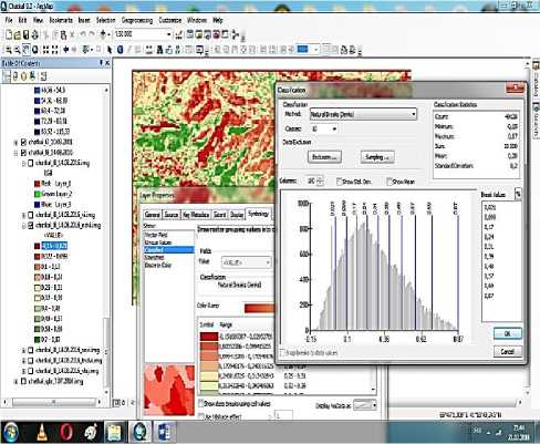
The creation of soil-landscape studies begins with the analysis of the relief, since the relief is a factor of landscape formation, and its impact is expressed through hypsometry, slope elements and slope exposures, the combination of which leads to the formation of landscape locations [8]. For the mountain territory of Uzbekistan, remote sensing data based on ArcGIS is used; a digital relief model (DRM) of the area under study is developed. DRM allows one to isolate the high-altitude zones of the research object, and draw up maps reflecting the character of slopes (exposure and steepness).
Analysis of high-rise terrain points and the parameters characterizing the slopes have shown that the tendency to increase the steepness of the slopes with increasing altitude is quite visible on the territory of the object under research. When compiling a soil-landscape map, it is necessary to classify the vegetation cover. Traditionally, this was carried out in field research, but at the moment with the onset of intensive introduction of modern technologies this task is solved much faster and more accurately on the basis of processing of remote sensing data.
In soil-landscape mapping, vegetation should be classified considering the quality-species composition and quantity characteristics — phytomass reserves. When classifying the quality characteristics of vegetation, it is necessary to use its spectral reflective properties in individual channels, and to determine the classification of quantity characteristics of vegetation, for example, wood, shrub and herbaceous vegetation, it is necessary to use a variety of vegetation indexes.
At present, there are more than 150 options of vegetation index calculations based on the two most stable sections of the spectral reflectivity curve of plants that do not depend on other factors [9]. RED-0.62–0.75 μm — the red zone of the spectrum is the maximum absorption of solar radiation by chlorophyll, and NIR-0.75–1.3 μm is the near infrared zone — the maximum energy reflection by the cellular structure of the leaves. This indicates a high photosynthetic activity associated with a large phytomass of vegetation, leading to lower values of reflection coefficients in the red zone of the spectrum and greater values in the near infrared zone.
The ratio of these two indicators makes it possible to clearly separate the vegetation cover from other natural objects. The best known vegetation index is the normalized difference vegetation index — NDVI (Normalized Difference Vegetation Index), based on the reflection ratio in the red and near infrared spectral zones. Its values range from -1 to +1. Contrary to this feature of reflection in the NIR-RED spectral regions, natural objects not related to vegetation cover will have a fixed value of the NDVI, which allows to use this parameter for their identification.
NDVI being an artificial dimensionless indicator is intended primarily to measure ecological and climatic characteristics of vegetation, and also to determine the parameters of humidity and organic saturation of soil, evapotranspiration. The dependence between these parameters and the NDVI is usually not direct and is related to the features of the studied area, its climatic and ecological characteristics; besides, it is often necessary to take into account the time division of the studied characteristic and the response of NDVI [10–11]. Due to the relative simplicity of computing the NDVI, it is widely used for the purpose of thematic mapping, including the creation of soil-landscape maps [12]. It is the spectral index of this type that is associated with such a landscape-geophysical indicator as phytomass reserves; especially in mountainous areas where there are local physical-geographical conditions: absolute altitude, exposure and steepness of the slopes on which the flux of solar radiation and the thermal regime depend, as well as the position with respect to the predominant transfer of air masses. It is necessary to take into account the fact that in the mountains it is customary to distinguish solar and circulation slopes on which plant communities of different types with different phytomass reserves are formed. As is known, phytomass is an indicator of in-landscape conditions and is a good criterion for isolating large contours (rank type) of landscapes.
The object of research is the mountain areas. To calculate spectral indices, summer photographs of the research object taken in June 1990 and 2016 were chosen, since at this time of year the vegetation is in the active vegetation phase. Preliminary processing of multispectral images of the Landsat series (geometric, thermal and atmospheric corrections) (Figгure 1–2), and the process of calculation of spectral indices were carried out using the ENVI 5.3 program.
The aim of these maps is to assess the degree of disturbance in the vegetation cover, monitor the dynamics of changes in vegetation cover over last 26 years (between 1990 and 2016).
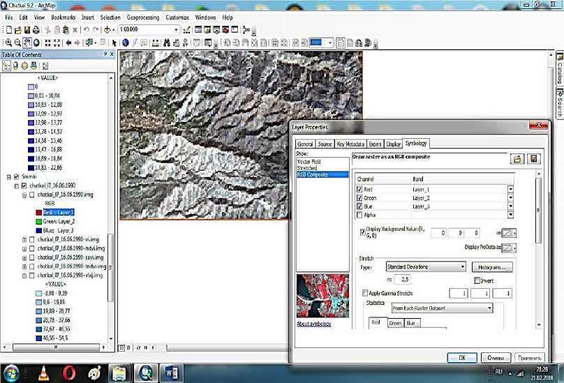
Figure 1. Satellite image of Landsat (1990, June 16).
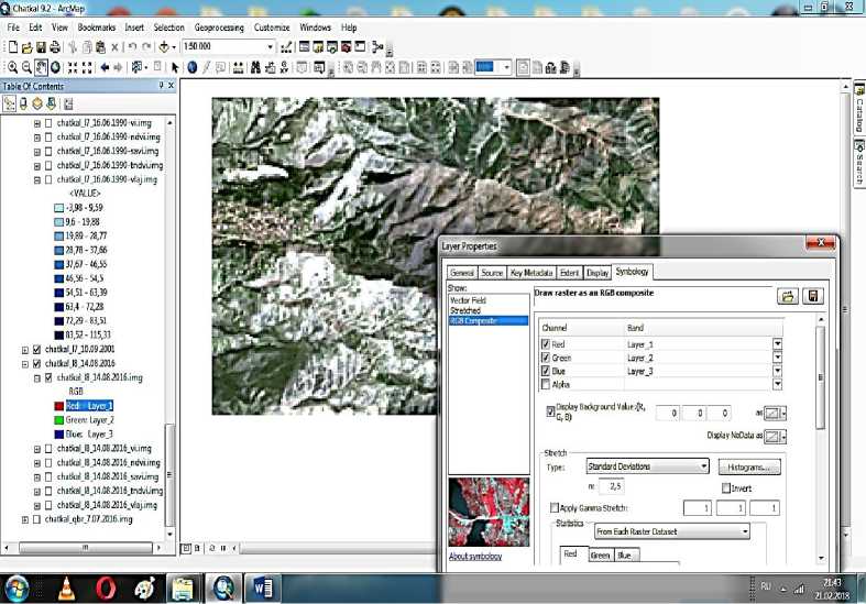
Figure 2. Satellite image of Landsat (2016, June 16).
As mentioned above, the stronger the process of photosynthesis, related to increased health and density of vegetation (i. e., approaching the state of an undisturbed ecosystem), the greater the percentage of reflected radiation in the infrared region, that is, the greater the value of the NDVI (Figure 3–4). This makes it possible to determine the quality and type of vegetation cover by analyzing the NDVI. A definite empirical correspondence between the value of the NDVI and the type of topsoil (including the type and quality of the vegetation cover) is presented in Table .
Table.
TYPE OF COVER — VALUE OF THE NDVI
|
NDVI |
Type of cover |
|
0,8–1,0 |
Very powerful, dense vegetation (tropical or broad-leaved healthy forest) |
|
0,67–0,8 |
Powerful, dense vegetation (forest) |
|
0,4–0,5 |
Scanty and sparse tree vegetation |
|
0,2–0,4 |
Shrubs and pastures |
|
0,09–0,2 |
Open soil |
|
-0,1 … +0,1 |
Rock mass, sand, snow |
|
-0,42 … -0,33 |
Water object |
|
-0,55 … -0,50 |
Anthropogenic cover (asphalt, concrete) |
|
0 |
Cloud image |
The construction of the NDVI by Landsat remote image allows to assess the type and state (degree of disturbance) of vegetation cover, including the forest cover at the date of survey. Comparison of maps of the NDVI for different years makes it possible to estimate the dynamics of the process of changing the state (to the best or to the worst) of vegetation cover in the period under consideration [13]. Below an analysis of the NDVI value for the research object is given.
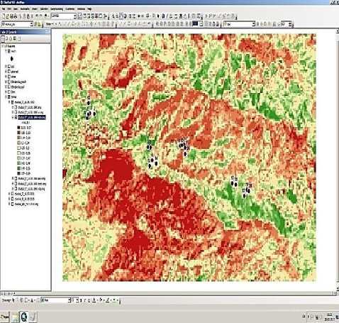
Figure 3. Map of distribution of NDVI (1990).
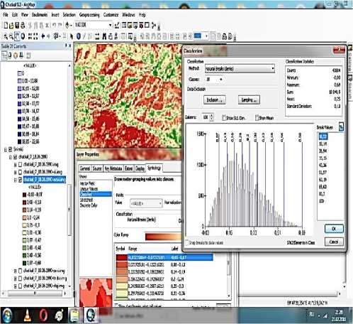
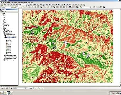
Figure 4. Map of distribution of NDVI (2016).
Values of the NDVI within 0.15–0.021 are confined primarily to high mountains, 3000 m and higher, that is, in the upper altitude range of high-mountain meadow landscapes. Here, the greatest areas are occupied by high-mountain subnival complexes, where the continuous vegetation cover is practically absent, and individual fragments of meadow vegetation are represented by spots. Natural complexes characterized by low values of the NDVI are found in the lower tier of mountains too: as in the highlands, these are the sites practically devoid of vegetation due to extremely low moisture content, as well as anthropogenic influence (overgrazing). The area of such land was 8.5% in 1990 and 9.1% — in 2016.
Values of the NDVI within 0,022–0,099 refer to open soil, herbaceous and shrubby vegetation, characteristic for 2500 m and lower, which corresponds to different vegetation options of grassy and shrubby vegetation type. However, the same values of the NDVI are characteristic for the foothill part, where they are similar to areas with steppe and semidesert vegetation, widely represented within the territory. Along with herbaceous cenosis, there are quite large fragments of shrubs and agricultural lands (fields, vineyards and pastures). The area of such land was 13.9% in 1990, and 11.3% — in 2016.
Values of the NDVI within 0.1–0.24 correspond to the sites with shrubby and sparse tree vegetation. In this category, there are cenoses with a certain type of vegetation, as well as landscapes for which woody natural territorial complexes with weak density of tree tier or low forests are more typical. This zone is a transition zone from steppe and semidesert landscapes to foothill zone; in the mid-mountains there is a transition from mountain forest to mountain meadow vegetation. The area of such land was 30.2% in 1990, and — 27% in 2016.
Values of the NDVI within 0.32–0.48 are quite widespread on the site of research and are typical for landscapes with shrub and sparse-tree character of vegetation. This type of landscape is located and confined mainly to the solar slopes, it is also found in extended sections of river valleys. Within this type of landscapes, one subtype of landscapes is distinguished: mid-mountains meadow, steppe, meadow-steppe type. The area of such land was 20.5% in 1990, and — 21.8% in 2016.
Values of the NDVI within 0.49–0.69 correspond to the sites on which a dense vegetation cover is formed (herbaceous or shrub natural-territorial complexes). This category of index includes natural territorial complexes related to both high-mountain meadow (subalpine) landscapes and to mountain temperate humid landscapes. In the highlands it is mainly a thicket. The area of such land was 10.4% in 1990, and — 14.01% in 2016.
Values of the NDVI higher than 0.7 correspond to different degrees of tree density. A singlevalued relationship between the NDVI and the woody character of vegetation is noted at its values higher than 0.85. The index in the range 0.80–0.85, in accordance with the index gradation (Table) corresponds to closed (dense) tree vegetation. The area of such land is 5.5%.
Conclusion
Based on data analysis, it could be concluded that for woody and shrubby vegetation, the main features of the assessment of soil protection capacity are: the closeness (density) of tree crowns and shrub belt and the state of the forest floor and topsoil cover. Vegetation is of meadowsteppe type, with large amount of herbs and shrubs, in places — juniper, spruce, apple, individual walnut trees. Practically intact vegetative community with good soil protection ability is observed in this area. The highest percentages of projective cover are characteristic for high turf. High- and medium-resistant species are found in the grassland. Communities of this category do not need special measures for restoration (except in insignificantly insolated eroded slopes). Rational use is all they require. From what has been said above, it follows that soils distributed on shadow slopes, with the exception of eroded differences, always have a powerful fine-grained cover, which does not contribute to the formation of surface runoff. Therefore, these sites are the best lands in mountainous areas.
There are plant communities with insignificant signs of disturbance, such as: a reduction in the percentage of turf cover (with a sufficiently high projective coverage) and the sites with weakly erosion-resistant species. Weak manifestation of erosion processes is observed (with the exception of eroded insolated slopes). These lands require partial surface improvement with regulation of use. Vegetation of this category requires partial reforestation measures aimed at increasing the closeness of crowns and the restoration of wood floor, as well as favorable conditions for the natural renewal of wood vegetation. Naturally, all plant communities need protection, continuous reforestation measures and facilitation in natural renewal.
References Long-term monitoring of the vegetation cover of mountain territories in the GIS for soil and landscape study of territories
- Dokuchaev, V. V. (1953). Nashi stepi prezhde i teper'. Moscow. (in Russian).
- Korovin, E. P. (1961-1962). Rastitel'nost' Srednei Azii i Yuzhnogo Kazakhstana. Tashkent.
- Kultiasov, M. V. (1946). Etyudy po formirovaniyu rastitel'nogo pokrova zharkikh pustyn' i stepei Srednei Azii. Materialy po istorii flory i rastitel'nosti SSSR, Moscow, 2, 257-282. (in Russian).
- Dzhalilova, G. T., Zabirov, F. M., & Ananova, K. K. (2017). Pochvenno-geobotanicheskoe obsledovanie gornykh territorii dlya razrabotki effektivnykh priemov bor'by s eroziei pochv. Web of Scholar, (8), 11-15. (in Russian).
- Kravchenko, I. V., Galachieva, L. A., Dzhandubaeva, T. Z., & Ibragimov, A. D. (2014). The assessment of the morphological features of the central caucasian relief for the analysis of the landscape formation. Dagestan State Pedagogical University. Journal. Natural and Exact Sciences, (3(28)), 92-97. (in Russian).
- Bratkov, V. V., Kravchenko, I. V., Tuaev, G. A., Ataev, Z. V., & Abdulzhalimov, A. A. (2016). Application of Vegetation Indexes for Mapping Landscapes of the Greater Caucasus. Dagestan State Pedagogical University. Natural and Exact Sciences, 10(4), 97-111. (in Russian).
- Bratkov, V. V. (2000). Fitomassa vysokogornykh lugovykh landshaftov Bol'shogo Kavkaza. Sovremennaya biogeografiya: Materialy Vserossiiskoi nauchnoi telekonferentsii, 11-20. (in Russian).
- Solntsev, N. A. (2001). Uchenie o landshafte. Moscow. (in Russian).
- Cherepanov, A. S., & Druzhinina, E. G. (2009). Spektral'nye svoistva rastitel'nosti i vegetatsionnye indeksy. Geomatika, (3), 28-32. (in Russian).
- Sutyrina, E. N. (2013). Distantsionnoe zondirovanie Zemli. Irkutsk. (in Russian).
- Kostrova, Yu. B., & Kostrov, B. V. (2010). Ispol'zovanie distantsionnogo zondirovaniya zemli v tselyakh povysheniya effektivnosti sel'skokhozyaistvennogo proizvodstva. Vestnik Ryazanskogo gosudarstvennogo agrotekhnologicheskogo universiteta im. P. A. Kostycheva, (3), 8890. (in Russian).
- Sochava, V. B. (1978). Vvedenie v uchenie o geosistemakh. Novosibirsk. (in Russian).
- Gafurova, L. A., & Dzhalilova, G. T. (2017). Sovremennyi podkhod k izucheniyu erozionnykh protsessov v basseine Sukoksai. Tashkent.
