Remote sensing for earth monitoring use of materials

Author: Adambaev A.R., Xamrayev E., Boymurodov R.Z.
Journal: Экономика и социум @ekonomika-socium
Section: Основной раздел
Article in issue: 6-1 (85), 2021.
Free access
The use of innovative technologies in the conduct of motorization of agricultural lands increases the quality of data. The article reveals the possibility of creating ground monitoring data in a fast way using drones and transmitting them to consumers.
Land monitoring, vector image, raster image, aero picture, remote sensing, metric information
Short address: https://sciup.org/140259521
IDR: 140259521 | UDC: 001
Text of the scientific article Remote sensing for earth monitoring use of materials
Introduction. The comprehensive study of land resources and territories in the territory of the Republic, the collection of the necessary information on their legal status, quantity and characteristics based on a single methodology, their unification into a single system is of great political, economic and social significance for our country. At the same time, effective land monitoring provides an opportunity to regularly study the potential of available land resources in the country. The implementation of the Land Code of the Oliy Majlis of the Republic of Uzbekistan, adopted in 1998, and the Regulation on Land Monitoring and regulations adopted on December 23, 2000, requires a great deal of work by specialists in the field. Land monitoring introduced in the Republic of Uzbekistan includes a system of observations on the current state of the entire land fund, its assessment, timely detection of changes in quality and quantity, elimination of negative consequences of land use. This means that land monitoring is one of the most pressing issues today. We consider it expedient to conduct land monitoring using remote sensing for the following purposes:
-
- observation of areas affected by anthropogenic sources;
-
- forecasting and assessment of land quality changes under the influence of natural and anthropogenic processes;
-
- timely notification and delivery of information on adverse changes in the land use process to public administration bodies.
Data processing and method. Land monitoring can be conducted in two different ways, namely ground surveys and land remote sensing. We consider it expedient to carry out land monitoring by remote sensing in several stages:
-
- selection of the observation time of the object according to the nature of radiation and light reflection;
-
- choose the type of imaging for the study area;
-
- take pictures on the selected system in a short time;
-
- Photogrammetric processing of the obtained images;
-
- Comparison of the identified data with the fund information;
-
- prediction of future events based on the analysis of the dynamics of land use processes.
Table 1
General scheme of ground monitoring on aero and space survey data.
|
Take monitoring go process |
Executable key works |
Work to be done content |
|
Preparation process |
The main technological cycle development |
The state of the dynamics of change of areas of land categories evaluation Shooting type and selection of parameters |
|
Aero and surface take a picture. |
According to the measurement result two or three dimensional image creation. |
Preliminary processing of survey results. |
|
Metric data get |
Raster and vector image input, photogrammetric reconstruction development, photo decryption |
Transform the image according to the given projection to obtain semantic data |
|
Funded and new data comparison. |
Raster, vector images and surface tracking data comparison Metric information and terrestrial tracking data Interdependence evaluation |
Taken at different times data synthesis. Metric quality change-identify |
|
Data creation. |
Digital model of space, electronic orthophotoplans, geoinformation layers, textual, tabular graphic data create a database. |
Information at different times storage, electronic and paper copies multiply |
The cost-effectiveness of remote sensing of the land surface is very high. For example, according to some data, the cost of using satellite information in hydrometeorological support and the amount of damage prevention is 2-3 times higher than the cost of obtaining it. However, the methodology of remote ground monitoring, which is based on the search for correlations (connections) between different data obtained by satellite, implies the loss of some of the information in comparison with the data examined on the ground.
Therefore, we consider it most expedient and effective to conduct land monitoring based on data collected at three different levels:
-
- from the ground (information collected at a certain time);
-
- from space (regular inspection by aircraft);
-
- Simultaneous use of data from space (using digital data or visual transmitters with satellite systems).
It is noted that the results of the authors' research allow solving the following tasks in exchange for a rapid assessment of the state of the earth using probing:
-
- Rapid ground and remote control of the territory to assess the ecological and functional status of natural, industrial complexes of energy, industrial and communication systems;
-
- preparation of aerial photographs for cartographic works;
-
- implementation of forest and water resources, urbanization of areas, negative processes, geological and hydrogeological monitoring;
-
- assessment of natural and man-made changes and the consequences and scale of emergencies;
-
- providing information on the state land cadastre and state control over land use and protection;
-
- timely receipt of timely and reliable information on the state of land use to make management decisions of public authorities;
-
- creation, updating and maintenance of the automated database.
Results and discussion. At present, there is an opportunity to record its electromagnetic waves in different spectral ranges based on modern technologies, the development of its territorial systems to form a single scientific and methodological approach to the organization of regional monitoring systems.
A database of different regions is formed with the help of various observations on the ground (topographic-geodetic, soil, reclamation, etc.) and remote inspection with a probe (space and aerial photography), inspections using archival data. We believe that the local land monitoring program in the Republic of Uzbekistan should create a section "Database of land monitoring" (district and city level) and a special place for the introduction and development of automated land information systems (AIS). In our opinion, the proposed AAT will be created to provide information to the subjects of public administration of Uzbekistan, local self-government. The AAT includes the main centre (republican level), regional centres (regional entities), local centres (city, district and mahalla assemblies) built on the sign of centralization.
Currently, digital aerial photography is used in remote sensing because space data does not provide the required accuracy in solving ground monitoring problems. A flying and controlled laboratory have been set up to ensure the required accuracy. These labs are equipped with a wide-format 136-megapixel Ultra CAM X camera and a hyperspectral CASI 1500 scanner. The Ultra CAM X camera can be fitted with special devices for high-resolution imaging of the location. It is recommended that decryption work for land monitoring be performed using the ENVI program. Remote sensing methods for land monitoring are being improved. Today, in many countries, ground monitoring is carried out using unmanned aerial vehicles (drones). The use of unmanned aerial vehicles in our country is entrusted to the state unitary enterprise "Geoinformkadastr" within the Committee "Davergeodezkadastr". Currently, the company has two types of unmanned aerial vehicles: Phantom 4Pro and Ptero GI.
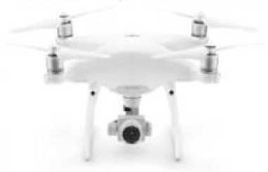
Figure 1. Phantom 4Pro unmanned aerial vehicle
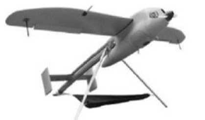
Figure 2. Unmanned aerial vehicles
Ptero-GI apparatus
These unmanned aerial vehicles allow for faster and more accurate ground monitoring data when used more in-ground monitoring. Distribution of agricultural lands in the territory of the Republic is also carried out with the help of modern land monitoring. Table 2 shows the results of land monitoring in the Republic of Karakalpakstan, the city of Tashkent and the regions. In this case, in part, the results of the drone-assisted shooting were used directly.
Lands used by agricultural enterprises and organizations (January 1, 2021)
Table 2
|
Name of regions |
Main land area. (thousand hectares) |
Including |
The village farmland types area (thousan d hectares) |
Relati ve to the total area (%) |
|||
|
S 5 ^ ^ о о |
11 h «8 5s 0 0-30 £ <^^ |
й и S E " 3 5 о о з -3 о ЗД ^ "^ |
^ ^ 1 ^ 3 -^ 3 "о £ о о ^ ^^ -3 |
||||
|
1 |
2 |
3 |
4 |
5 |
6 |
7 |
8 |
|
Karakalpakstan Republic |
3166.9 |
415.6 |
7.8 |
9.4 |
1709.4 |
2142.2 |
67.6 |
|
Andijan region |
365.1 |
201.4 |
29.6 |
2.5 |
17.9 |
251.4 |
68.9 |
|
Bukhara region |
3414.1 |
199.3 |
20.2 |
6.5 |
2317.8 |
2543.8 |
74.5 |
|
Jizzakh region |
1423.7 |
477.7 |
17 |
8.1 |
657.2 |
1160 |
81.5 |
|
Kashkadarya region |
2337.8 |
675.4 |
36.4 |
20.8 |
1224.2 |
1956.8 |
83.7 |
|
Navoi region |
4095.3 |
109.3 |
9.9 |
6.7 |
3462.7 |
3588.6 |
87.6 |
|
Namangan province |
495.4 |
190 |
42 |
2.5 |
48.3 |
282.8 |
57.1 |
|
Samarkand region |
1478.1 |
425.4 |
65.1 |
5.2 |
707.3 |
1203 |
81.4 |
|
Surkhandarya |
1366.3 |
278.1 |
32.2 |
0.3 |
698.1 |
1008.7 |
73.8 |
|
region |
|||||||
|
Syrdarya region |
372.2 |
248.1 |
6.9 |
9.9 |
18.8 |
283.7 |
76.2 |
|
Tashkent region |
775.7 |
327.7 |
48.8 |
0.7 |
201.9 |
579.1 |
74.6 |
|
Fergana region |
562.0 |
246.9 |
48.1 |
19 |
314 |
55.9 |
|
|
Khorezm region |
408.9 |
204.1 |
12.7 |
3.8 |
8.9 |
229.5 |
56.1 |
|
Tashkent city |
0.1 |
0.1 |
0.1 |
100 |
|||
|
Total: |
20261.6 |
3999.0 |
376.8 |
76.4 |
11091.5 |
15543.7 |
76.7 |
Note: The table is based on the data of the State Committee "Davergeodezkadastr".
Conclusions. The quality, accuracy, and reliability of ground monitoring data, as noted above, are largely achieved through the widespread use of modern drones. However, the fact that land accounting is now carried out more traditionally limits the quality of land monitoring data and the ability to deliver it to consumers in a fast way. Therefore, as a result of the research, the use of remote sensing materials and innovative technologies in land monitoring, recommended by the authors, is considered appropriate. Extensive use of remote sensing methods in land monitoring in the country will help increase the efficiency of land monitoring and ensure the accuracy of information.
References Remote sensing for earth monitoring use of materials
- К.Р.Рахмонов. "Ер мониторинги". Ўқув қўланма. ТИҚХММИ, Тошкент, 2017 й. - 145 б.
- M.S.Akbarov., Dj.K.Muxitdinov "Fotogrammetriya" O'quv qo'llanma, "Tafakkur bo'stoni" Тошкент 2015 й. - 160 b.
- www."Davyergeodezkadastr. Uz, 2011
- Ш.Қ. Майинов., У.П. Исломов., С.З. Сафаев., Р.Н. Шаропов. "Геодезия,картография ва давлат кадастр ишларида инновацион технологияларни жорий этиш". Журнал "Интернаука" №14(48) част 2. 2018 г. 83 стр.
