Rural Communities of Yakutia in Conditions of Permafrost Degradation: Key Risks, Social Consequences, and Adaptation Mechanisms

Author: Suleymanov A.A., Lytkin V.M., Vinokurova L.I., Grigoryev S.A., Fedorov S.I., Golomareva V.Yu., Basharin N.I., Aprosimov D.A.
Journal: Arctic and North @arctic-and-north
Section: Northern and arctic societies
Article in issue: 52, 2023.
Free access
During the period of global climate change, the territories of the Russian Federation, within which permafrost is widespread, are at particular risk. The aim of this article is to identify the social consequences of permafrost degradation on the example of a number of rural settlements in the Republic of Sakha (Yakutia) and to determine the emerging mechanisms of adaptation to the challenges associated with changes in the habitual state of the environment. In this regard, for the first time, the villages of Amga, Yunkur, Argakhtakh, Lippe-Atakh and Ulakhan-An, located in Yakutia, were the focus of relevant interdisciplinary research conducted during 2019–2022. The work in these settlements made it possible to establish local features of both the consequences of the degradation of permafrost and the specifics of their perception by the local population. It is noted that in the rural settlements studied, permafrost degradation limits the development of traditional economic activities, including among the Arctic and Subarctic indigenous population, limits the possibilities for the spatial development of settlements, leads to problems with the safety of the housing stock, and hinders transport communication. The observed changes entail an increase in the financial burden on the population, economic entities and local administrations, and negatively affect the social well-being of the inhabitants of the studied villages. At the same time, the conducted research allowed to reveal that the mechanisms of adaptation and sustainability of rural communities that are being formed in this regard are largely based on traditions of rural mutual assistance.
Arctic, Yakutia, rural community, life support system, permafrost, thermokarst
Short address: https://sciup.org/148329482
IDR: 148329482 | UDC: 572.021(571.56) | DOI: 10.37482/issn2221-2698.2023.52.199
Text of the scientific article Rural Communities of Yakutia in Conditions of Permafrost Degradation: Key Risks, Social Consequences, and Adaptation Mechanisms
The research was supported by the Russian Science Foundation grant No. 19-78-10088,
The Republic of Sakha (Yakutia) (hereinafter referred to as the RS(Ya)/Yakutia) occupies an area of 3103.2 thousand km² and is not only the largest subject of the Russian Federation, but also the largest administrative-territorial unit in the world. The vast territory of the region is almost entirely located in the zone of continuous distribution of deep-frozen soil — permafrost. This natural phenomenon reaches its maximum thickness here — about 1.5 km [1, Suleymanov A.A., p. 117].
Highly icy soils (volumetric ice content from 0.4 to 0.8) occupy 39.8% of the total area of Yakutia [2]. In the conditions of modern climate change with a rapid increase in average annual air temperature in the Arctic and Subarctic, they are in the high-risk zone. Analysis of meteorological data from 52 weather stations in Yakutia, conducted by the candidate of geographical sciences Yu.B. Skachkov, showed that the region has seen a widespread increase in average annual air temperature over the past half century. This indicator increased by 2.0°C on average over the territory of Yakutia. At the same time, the increase is caused mainly by the warming of the winter seasons, which are the seasons with the largest deviations from the temperature norms [3].
The resulting “cold deficit” (its comparative shortage in relation to previous periods) [4, Suleymanov A.A., pp. 29–30] along with the consequences of anthropogenic impact led to the acceleration of permafrost degradation processes. The most vulnerable permafrost is located under open landscapes (mainly meadows) of the ice complex or yedoma, which are characterized by a thin protective layer (̴0.2 m), i.e. the zone between the base of the seasonal thawing layer and the top of the ice complex [5, Efimov G.F.], while in areas covered with boreal forest, its thickness reaches 0.7–1.0 m [6, Fedorov A.N.]. The peculiarity of this layer is also very high ice content of the surrounding soils (up to 60-70%). This horizon prevents permafrost thawing [7, Shur Y.]. As a result of climate warming, the protective layer is being destroyed, which leads to the rapid development of thermokarst processes — soil subsidence due to the melting of underground ice [8, Grosse G.]. Thermokarst refers to cryogenic processes that result in the formation of characteristic relief forms [9, Kachurin S.P.; 10, Fedorov A.N.] (Fig. 1–2).
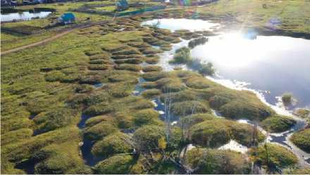
Fig. 1. Thermokarst landforms — bylars and duyodya — Fig. 2. Thermokarst landforms — bylars — on the on the territory of the village Yunkyur, September 2022. territory of the village Amga, September 2021.
Photo by A.A. Suleymanov. Photo by A.A. Suleymanov.
It is expected that permafrost degradation, including the development of thermokarst, will affect 33.6% of the infrastructure in Yakutia by the middle of the 21st century, which will entail large social and economic costs for the region [11, Streletskiy D.A.]. The established life support systems of both urban and rural communities in the region are under threat. However, the latter are most dependent on the state of the environment and are currently experiencing the main pressure. Thus, the study of various aspects of the dynamics of the permafrost zone and its impact on the population of Yakutia has significant relevance and practical significance.
Research in this direction can contribute to the development of timely measures to prevent the occurrence and mitigation of the impact of dangerous cryogenic processes on the population and economic entities, taking into account the experience accumulated by representatives of local communities affected by thermokarst in responding and adapting to negative changes in the state of the environment, developing effective recommendations for authorities at various levels based on a set of obtained materials.
The relevance and significance of the above-mentioned problems cause an increased interest in the scientific development of a wide range of issues related to it both from domestic and foreign researchers. In recent years, a number of scientific works related to the degradation of permafrost soils have been published [12, Lupachev A.V.; 13, Sannikova E.E.; 14, Melnikov V.P.; 15, Zhirkov A.; 16, Lytkin L.V., etc.]. In particular, according to the results of recent studies conducted in the central regions of Yakutia, a high intensity of thermokarst development was noted, while the rate of surface subsidence can reach 10–15 cm per year [10, Fedorov A.N.; 17, Saito H.].
At the same time, there are relatively few papers that cover the consequences of permafrost degradation for the life of the population of Yakutia. For example, N.I. Shiklomanov and D.A. Streletskiy analyzed potential changes in the sustainability of Russian urban infrastructure built on “permafrost” under predicted climate changes, as well as the negative effects of climate change in the Arctic for urban settlements in the area, including the city of Yakutsk [18]. N. Doloisio and J.-P. Vanderlinden studied the perceptions of permafrost degradation among the population of the administrative center of the region [19]. In addition, there are a number of studies (except for several articles by the authors of this work) that examined the economic and sociocultural consequences of global climate transformations, including permafrost degradation, for the indigenous peoples of Yakutia [20, Svinoboev A.N.; 21, Fujiwara J.; 22, Ananicheva M.D. et al.].
In terms of cooperation between representatives of the natural sciences and humanities, it is worth noting the work of Russian and Japanese researchers within the framework of the project “Designing educational materials for environmental education related to the local history of Siberia, synthesizing cultural memories with scientific knowledge” in 2016–2020. Research conducted in the Churapchinskiy and Gornyy uluses of Yakutia addressed the problems of the impact of climate change, including permafrost degradation, on local rural communities and their adaptation to changing conditions. At the same time, the focus of the research was mainly aimed at identifying the characteristics of local residents’ perception of climate change, as well as the dynamics of
NORTHERN AND ARCTIC SOCIETIES
Aleksandr A. Suleymanov, Vasiliy M. Lytkin, Liliya I. Vinokurova, Stepan A. Grigoryev … change and contradictions in public opinion when assessing the observed natural transformations. The project participants identified, among other things, 3 measures that the population of the Churapchinskiy and Gornyy uluses undertake to mitigate the consequences of degradation of permafrost: leveling the land surface in places of thermokarst development, constructing embankments under houses, as well as “selecting cultivated crops and varieties that correspond to ongoing climate changes” [23, Takakura H.; 24, Takakura H.].
The authors of the presented work agree that the problem of permafrost “melting” should be studied precisely through the interaction of representatives of various scientific disciplines. At the same time, it seems necessary to note that, as our experience has shown, there are quite serious local features in the consequences of permafrost degradation, its perception and ways of adaptation associated with both the geographical conditions of a particular area and the specificity of life support systems locally formed. Accordingly, the more settlements in Yakutia are covered by such research, the more objective and multifaceted the picture of the analyzed problems will be.
The aim of this study is to determine the impact of permafrost degradation and thermokarst processes on the livelihoods of rural communities in Yakutia on the example of 5 settlements of the region, to identify the consequences of emerging challenges, as well as the mechanisms of adaptation to them.
Materials and methods
The authors focused their work on research in the villages of Amga of Amginskiy and Yunkyur of Olekminskiy uluses (districts). These settlements were chosen due to a number of factors. Both villages are united by history: Russian settlers made the first attempts to introduce regional agriculture on their territory. During the Soviet period, the Amginskiy and Olekminskiy districts of Yakutia were even called the “second Ukraine”. As will be shown below, the development of thermokarst processes is quite closely related to soil cultivation for agricultural crops. For this reason, Amga and Yunkyur are characterized by active degradation of permafrost. However, these processes and their impact on local communities were not the focus of scientists’ attention at the beginning of our research. There are also certain differences between Amga and Yunkyur that are of comparative interest. First of all, they are located in different geographical areas of Yakutia: Amga is located in Central Yakutia, Yunkyur is in South-Western Yakutia.
For the same purposes — for comparison and more complete coverage of the various aspects and features of thermokarst processes in different geographical conditions — the materials identified during research in the villages of Argakhtakh of Srednekolymskiy, Lippe-Atakh of Verkh-nevilyuyskiy and Ulakhan-An of Khangalasskiy uluses (districts) were used in writing this article. The first of these villages is located in the Arctic zone of Yakutia and the consequences of permafrost degradation here have their own serious specifics; the same can be said about Lippe-Atakh, located in the western part of the region, which is less susceptible to thermokarst. Despite the fact that the bulk of the field materials obtained in autumn 2022 has not yet been processed, the au- thors decided to include the example of Ulakhan-An village (central part of the region) in the article. Only in recent years, the villagers have closely encountered the manifestations of permafrost degradation, which has led to certain nuances in the perception of ongoing processes and the peculiarities of their response to them.
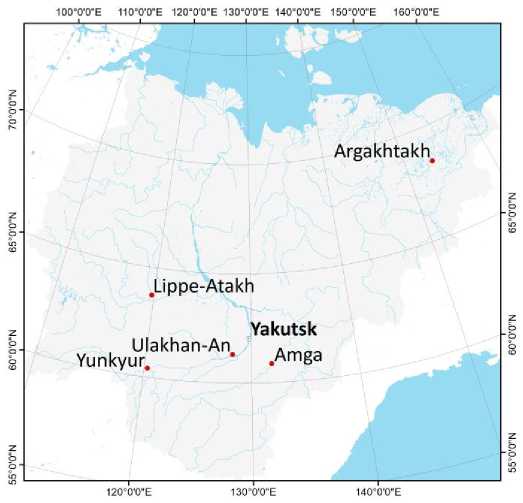
Fig. 3. Research locations in 2019–2022.
Field research in Amga (with the adjacent village of Chapchylgan) and Yunkyur was carried out in autumn 2019, 2020 and 2021 within the framework of project No. 19-78-10088, supported by the Russian Science Foundation, “Cryoanthropology: natural low temperatures in the life support system of rural communities of Yakutia (traditional practices, modern challenges and adaptation strategies)”. The importance of conducting research within approximately the same time frame is due to the need for maximum representativeness and correct correlation of the data obtained, since the seasonal thawing of permafrost reaches its apogee in September-early October; the consequences of its degradation for residential and commercial structures, infrastructure and farmland become most obvious.
In the first year, the work included landscape-permafrost surveying of the area, selection of key research areas and equipment of sites for temperature monitoring of permafrost soils. The selected key areas are located in the vicinity of Amga and Yunkyur and represent open surfaces where thermokarst processes are actively developing. Two boreholes were drilled in the vicinity of each settlement to assess changes in the active layer and temperature regime, which have a direct impact on thermokarst activation. The location of one of the boreholes was confined to a human-disturbed surface, which was formed by bylars [25, Solovyov P.A.] (the initial stage of thermokarst in the form of a hilly surface) (Fig. 4–5). The choice of location for the second borehole was linked to the limits of the natural landscape covered with larch forest, not subject to significant anthropogenic impact and not affected by thermokarst.
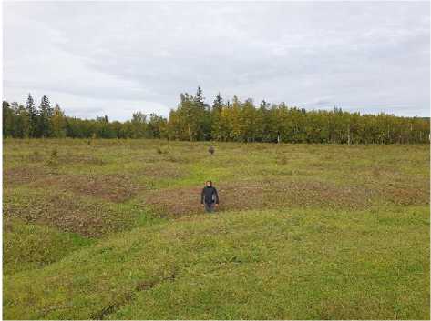
Fig. 4. Location of borehole no. 1 in the vicinity of the village Yunkyur, September 2021. Photo by A.A. Suleymanov.
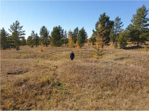
Fig. 5. Location of borehole no. 4 in the vicinity of the village Amga, September 2021. Photo by V.M.
Lytkin.
Boreholes 4.5 and 8 meters deep were drilled in the vicinity of the village of Yunkyur. Borehole no. 1 was drilled within an abandoned arable land, where thermokarst is now intensively occurring. In this well, at a depth of 2 m, ice-wedge casts was discovered, which can be traced to bottom (4.5 m). Borehole no. 2 was drilled on the surface of a mixed spruce-birch forest, which was not affected by anthropogenic impact (natural landscape). In this mine, ice-wedge casts was exposed in the interval of 4.9–7.2 m.
As a result of the work performed on the territory of the village Amga, boreholes with a depth of 7.5 (no. 3) and 10 (no. 4) meters were drilled. Well no. 3 was drilled in a mixed birch-larch forest, well no. 4 — on the surface of an abandoned arable land at the top of a bylar.
The drilled boreholes were equipped with logger-type sensors produced by Rusgeotech LLC with an accuracy of ±0.01°C to record soil temperatures at depths of 0, 1, 3, 5, 7 and 10 meters. In addition, orthophotomaps of key research areas were created. The orthophotomaps were obtained using a DJI Mavic 2 Pro unmanned aerial vehicle (UAV) and GNSS georeferenced based on the creation of a reference frame. The reference points were georeferenced using Trimble 5700 high-precision geodetic equipment.
The geocryological part of the research in Amga and Yunkyur during the second and third years of work included repeated landscape-permafrost surveys of the area, documentation and GPS-mapping of decipherable relief features for further mapping of these territories. Along with the above-mentioned surveys, repeated aerial photography of the monitoring sites was carried out using UAVs. In addition, data from logger devices was extracted, which provided continuous monitoring of the temperature regime of the soil.
Based on the analysis and comparison of multi-temporal aerial images and a digital relief model of key research areas made in 2019, 2020 and 2021, the calculation of the dynamics of thermokarst processes was also carried out. The UAV-derived images were processed using the specialized ArcMap 10.1 software.
At the same time, a sociological survey was conducted during the field surveys in Yunkyur and Amga villages, covering 37 people in 2019, 211 people in 2020 and 80 people in 2021. The sociological research tools included sociological survey questionnaires and questionnaires for expert survey. The questionnaire consisted of 22 questions. For most of them, respondents had to give one of two or more answer options. The processing of materials obtained during the survey and the formation of final data sets were carried out in the format of a specialized statistical program SPSS Statistics v. 25. Heads or leading specialists of the village administration, as well as representatives of large (by local standards) business entities, took part in the expert survey. The main objectives of the expert interviews and questionnaires were to obtain information on local communities’ assessment of the current state of the natural environment, existing or expected threats due to the “cold deficit” and active thermokarst processes, as well as to track current and potential practices of response and adaptation.
In parallel with the sociological research in Amga and Yunkyur, historical and anthropological research was conducted to study the historical evolution of the significance of permafrost in the livelihoods of local rural communities. This part of the work included conducting in-depth and narrative interviews based on a single questionnaire, mainly among old-timers, i.e. people who lived in the studied locality for at least 60 years, and covered 29 people over three years of research. For in-depth and narrative interviews, the “snowball” method was used to identify respondents with specific knowledge of the issues addressed by the project, since neighborhood ties are strong in local rural communities and the interviewees could quite accurately identify persons of interest for the study.
These methods were combined with visual identification and recording of material sources indicating the consequences of permafrost degradation, using photo and video equipment. In particular, damaged rural buildings (residential and commercial), infrastructure and landscapes were recorded. For better clarity and understanding of the ongoing processes, the article presents photographs taken in September 2022.
As noted, in order to create a more complete and comprehensive picture characterizing the consequences of permafrost degradation, field research were carried out in other settlements of Yakutia. In March-April 2021, surveys were carried out in the Argakhtakh village, in September 2021 — in the Lippe-Atakh village, in August 2022 — in the Ulakhan-An village. Activities in these settlements also included a complex of interdisciplinary work, but for this article, the results of reconnaissance geocryological surveys, expert and in-depth interviewing, conducted according to the same program as before, are mainly of interest.
History of economic development of territories and climate regime dynamics
Before proceeding directly to the analysis of the results obtained during the research, it seems necessary to briefly characterize the history of economic development and the current socio-economic situation, as well as the dynamics of the air temperature regime.
As noted, the Amginskiy and Olekminskiy uluses (districts) of Yakutia were the pioneers in the introduction of agriculture in the region by Russian settlers. Thus, according to F.G. Safronov, the first attempt to settle the middle reaches of the Amga river dates back to 1652. Thirty years later, 17 families lived in the Amginskaya settlement. In 1862, the population of the settlement was 798 people. Farming and cattle breeding remained the leading branches of economy all this time [26, Safronov F.G., pp. 114–115]. In 1930, Amga became the administrative center of the created Amginskiy district of Yakutia. Almost simultaneously, the Pobeda collective farm appeared in Amga, which later became part of the Amginskiy state farm that existed until the collapse of the USSR. The increase of the area cultivated by the Amginskiy state farm is an important indicator in terms of the problems under study. Thus, in the period from 1957 to 1992, 1702 hectares of uncultivated and about 4200 hectares of virgin and fallow lands were ploughed [27, Fedorov V.V., pp. 18–25].
After the collapse of the Soviet Union and the socio-economic crisis in Russia, large state-owned collective farms were liquidated and replaced by much smaller enterprises representing both state and private forms of ownership. At the same time, the area of cultivated land in Amga ulus was significantly reduced from about 13 thousand hectares in 1990 1 to 8 thousand by 2018 2.
Another indicator that should be emphasized is the dynamics of the Amga population. The Soviet period was characterized by a significant increase in population. Thus, in 1939, there were 1230 people living in Amga, and in 1989 — already 5191 people 3. The population of Amga, with rare exceptions, increased annually in the post-Soviet period due to the fact that the village, as noted, is the regional center of the Amga ulus. As of the beginning of 2022, the population of Amga was 6645 people 4. Agriculture occupies a leading place in the economy: meat and dairy cattle breeding, meat herd horse breeding, growing crops — vegetables, grains and fodder 5.
The agricultural development of the modern territory of Yunkyur began approximately at the same time as the development of the Amginskaya settlement. In the middle of the 17th century, on the right bank of the Malaya Cherepanikha River in the area of its mouth, i.e. approximately where Yunkyur is located now, the village of Olekminskaya was founded by Russian peasants [26, Safronov F.G., p. 113]. At the end of the 18th century, Vilyui and Amga peasants were resettled to these places due to poor harvests. They founded a new village, which the latter named “Amgin-skaya” in memory of their native places. The main occupation of the peasants was agriculture and cattle breeding. Thus, according to data for 1917, 655 hectares of land were sown here [28, Redko M.A., pp. 5–6]. During collectivization, since 1927, Yunkur served as the center of various collec- tive farms, since 1951 — of the united collective farm “Pravda”, and since 1971 — of the state farm “Olekminskiy” 6.
The most important sectors of the economy of the Yunkur people in the USSR years were cattle breeding and grain growing, as well as well-developed vegetable growing. As in the case of the Amginskiy state farm, the Yunkyur branch was characterized by a significant increase in the area of cultivated plots. For example, this figure was 4697 hectares in 1977 7. For comparison, the area of cultivated plots decreased to 2260 hectares by 2019, i.e. more than halved 8.
The population of Yunkyur was constantly increasing during the Soviet period: in 1938, there were 335 people in the village 9, in 1984 — 1058 people 10. After the collapse of the USSR, the number of residents in Yunkyur remained quite stable for a long time and in 2012 it was 1139 people 11. However, in recent years, the outflow of population has accelerated significantly, and now the village is inhabited by less than a thousand people. As of 2022, the population of Yunkyur was 953 people 12. At the same time, these indicators are quite high by the standards of modern Yakutia for a rural settlement that is not the administrative center of an ulus (district) of the republic and is far from its capital. This fact is connected, first of all, with the proximity of the regional center — the city of Olekminsk, where, according to information received during an interview with the head of the village, about 3/4 of the working population travels from Yunkyur to work 13. The economy of Yunkyur is still based on meat and dairy cattle breeding, herd horse breeding and cultivation of grain crops 14. The production base of one of the modern flagships of Yakutia’s agriculture, LLC Kladovaya Olekmy, is located here.
Thus, summarizing a brief overview of the history and current situation in Amga and Yunkyur, three key characteristics should be noted. In both cases, there has been an increase in the area of land brought into agricultural circulation for more than three centuries, especially accelerated during the Soviet period. In both cases, with the collapse of the Soviet Union and the economic crisis, there was a significant sequestration of the area of cultivated land. The second point is the population growth in Amga and Yunkyur. While in Yunkyur it stopped, although the number of residents is still significant, in Amga it continues to grow to this day. Finally, the basis of the economy of both settlements is agriculture.
Another unifying characteristic is the rhythmic increase in average annual air tempera tures: according to the Amga weather station, during 1966–2021, the average annual air tempera- ture increased from -12.5°C to -8.8°C, in Olekminsk during the same period — from -8.4°C to -
5.1°C (see Fig. 6–7).
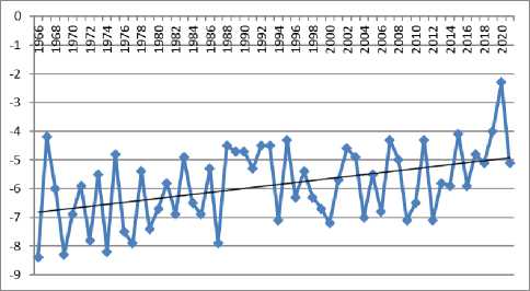
Fig. 6. Dynamics of average annual air temperature in 1966–2021 according to data from the Olekminsk weather station.
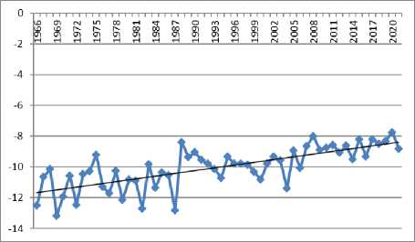
Fig. 7. Dynamics of average annual air temperature in 1966–2021 according to the Amga weather station.
To a large extent, it was the superposition of two factors: extensive cultivation of lands and subsequent abandonment of croplands, as well as a rhythmic increase in average annual air temperature that led to the consequences that will be discussed below.
Consequences of anthropogenic impact and climate change
The creation of arable land was associated with the cutting down of forest plantations and bushes, which had previously shaded these areas and prevented them from being warmed by sunlight. If constant cultivation and sowing of lands together with a colder temperature regime generally neutralized the processes of permafrost degradation, their abandonment in the post-Soviet period led to a significant activation of thermokarst [29, Ugarov I.S.]. The situation was aggravated by the fact that the needs for spatial development of rural settlements that were quite large, by the standards of Yakutia, led to the fact that part of former arable lands was given over for housing construction.
In this regard, the results obtained during the research conducted in Amga and Yunkyur in 2019-2021 are indicative. Research has shown that for natural landscapes, where the original natural conditions were not disturbed during the economic development of territories, the permafrost temperature regime turned out to be stable over the entire observation period. The development of negative cryogenic processes in such areas was not detected. Thus, in borehole no. 2 in the vicinity of Yunkyur village, at a depth of 3 m, the average annual soil temperatures are below -1°C and drop to -1.5°C at a depth of 8 m. In borehole no. 3 at the Amga site, soil temperatures at the same depths were -1.7 °C and -1.8 °C, respectively. As a result, the depth of the seasonally thawed layer does not reach the roof of heavily icy soils and is 1.7 m in the Yunkyur village and 1.3 m in Amga. This circumstance has a beneficial effect on the resistance of such landscapes to thermokarst processes. The noted differences in soil temperatures are associated with the natural geographical features of Yunkyur and Amga: the first is located on the southern border of the con- tinuous permafrost zone, where the climate is milder and average annual air temperatures are about -5.1°C, and the second one is located in the central part of the continuous permafrost zone, where its thickness can reach 600 m, and the average annual air temperature is about -8.5°C.
These factors also play an important role in the formation of soil temperature regime in anthropogenically disturbed areas — the territory of abandoned arable land. For such landscapes, ground temperatures were much higher due to the disruption of the heat balance regime of the surface because of the reduction of dense vegetation cover. The temperature regime of soils at a depth of 3 m is of the greatest interest. This horizon is the roof of ice-wedge casts in the studied areas, changes in which affect the development and dynamics of thermokarst processes. During the observation period, the average temperature in disturbed landscapes at this depth remains stable at two study sites. However, the average annual temperature in well no. 1, located in the vicinity of the Yunkyur village, is only -0.31°C, in well no. 4, located in the vicinity of the Amga village, — -0.64°C [30, Lytkin V.M., p. 426].
The obtained temperature regimes of soils in disturbed landscapes on the roof of permafrost and ice-wedge casts affect the depth of seasonal thawing (in the vicinity of Yunkyur — 2.1 m, in Amga — 2.4 m), which is reflected in the rate of thermokarst processes. These territories are characterized by the annual deepening of inter-bylar hollows. At the key study site in the vicinity of Yunkyur village, the relief surface subsided by an average of 14 cm during the observation period due to subsurface ice melt: by 8 cm during 2019-2020 and by 6 cm during 2020–2021; near the village Amga — on average by 11 cm: by 6 cm in 2019–2020 and by 5 cm in 2020–2021 (Fig. 8–9).
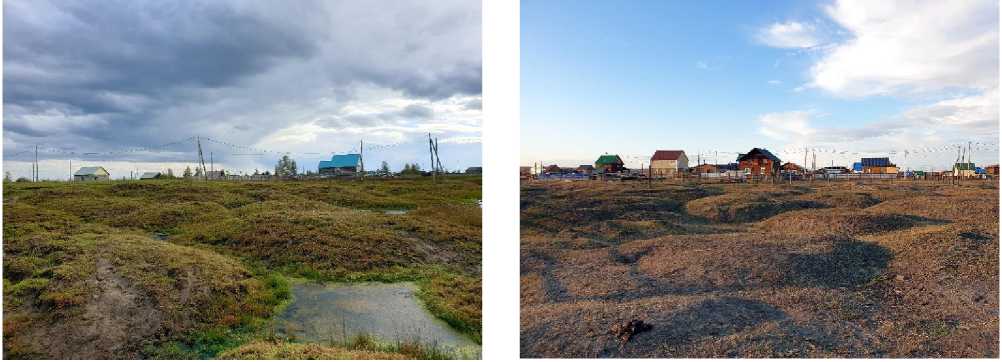
Fig. 8. Inter-bylar hollows in the Yunkyur village, Fig. 9. Inter-bylar hollows in the Amga village, Sep-
September 2022. Photo by A.A. Suleymanov. tember 2021. Photo by A.A. Suleymanov.
Due to the deepening of such hollows and their merger, duyodya is formed — a form of thermokarst relief in the form of round depressions filled with water, which are the original thermokarst lakes (Fig. 10–11). There are 21 such lakes on the Yunkyur territory. Their maximum area is 10.672 m2, minimum — 620 m2. For the period 2019–2021, the surface area of some lakes increased by 40%, which is likely due to the increase in average annual air temperature.
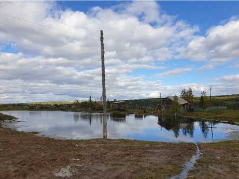
Fig. 10. Dyuodya in the Yunkyur village, September 2022. Photo by A.A. Suleymanov.
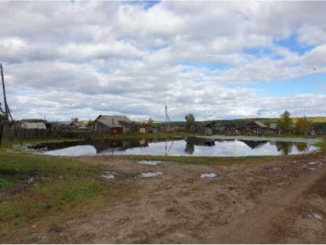
Fig. 11. Dyuodya in the Yunkyur village, September 2022. Photo by A.A. Suleymanov.
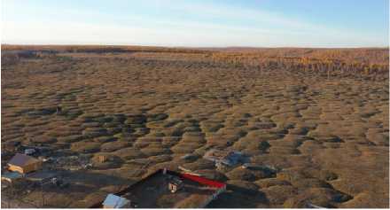
In general, the research showed that negative cryogenic processes cover 19.5% of all yard areas in the Yunkyur village and 18% in the Amga village (Fig. 12–13).
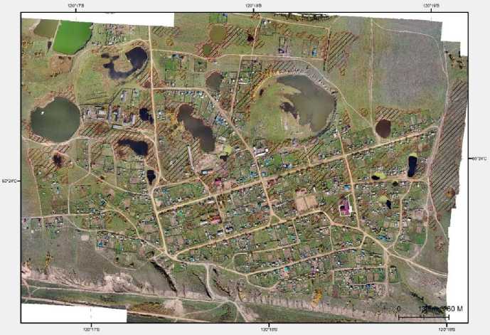
Fig. 12. Distribution of thermokarst processes (bylars) in the Yunkyur village. Compiled on the basis of the results of the 2019–2021 research.
Fig. 13. Distribution of thermokarst processes (byllars) in the Amga village. Compiled on the basis of the results of the 2019–2021 research.
Influence of permafrost degradation on local life support systems
The noted processes led to a number of negative consequences for the existing life support systems of Amga and Yunkyur. Thus, the degradation of permafrost leads to the deformation of residential and commercial buildings. In Yunkyur, the area of thermokarst forms (bylars) includes 249 residential and utility buildings, in Amga — 540. Some of the affected houses and buildings have to be regularly repaired by the local population (19% of respondents in Amga and 36% in Yunkyur), and some are completely abandoned and rebuilt in another place (Fig. 14–15) 15.
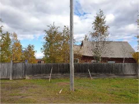
Fig. 14. One of the houses affected by thermokarst.
A new house, to which the owners of the site were forced to move, is in the background on the left, Yunkyur, September 2022. Photo by A.A. Suleymanov.
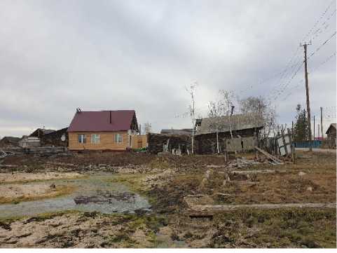
Fig. 15. Abandoned and new houses on the site damaged due to the activation of thermokarst on the site in Amga, September 2021. Photo by A.A. Suleymanov.
Among the affected, for example, is the “Orphanage” in the Yunkyur village, intended for socially vulnerable groups of the population (Fig. 16–17) 16. An example of one of the apartment buildings in the Amga village, located on Mira Street, is also indicative. The municipality had to re- settle its residents because of the threat of house collapse due to permafrost degradation (Fig.
18–19) 17
Fig. 16. “Orphanage” in the Yunkyur village,
September 2022. Photo by A.A. Suleymanov.
Fig. 17. “Orphanage” in the Yunkyur village, September 2022. Photo by A.A. Suleymanov.
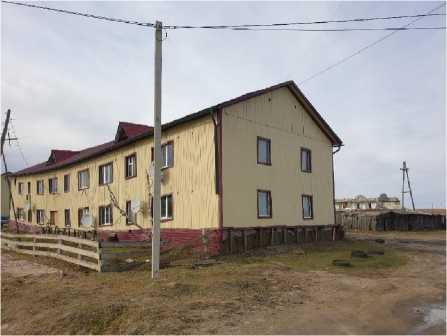
Fig. 18. Apartment building on the Mira Street, affected by thermokarst.
Fig. 19. Apartment building on the Mira street, affected by thermokarst. At the time of research, only one family lived in the house, preparing to move, Amga, September 2021. Photo by A.A. Suleymanov.
The population of entire micro-districts on the territory of former arable lands suffers from the degradation of permafrost. In this case, the example of the new Neleger micro-district in Amga, located on the territory of the abandoned lands of the Amginskiy state farm, is representative. Plots here, among other things, were allocated to low-income families with the condition of rapid development. As a result, as can be seen from Fig. 20–22, the construction of houses had to be carried out on an area completely covered by thermokarst processes. The main reason is the shortage of land in Amga, superimposed on the continuous population growth. For this reason, among other things, a significant density of buildings in the village was observed.
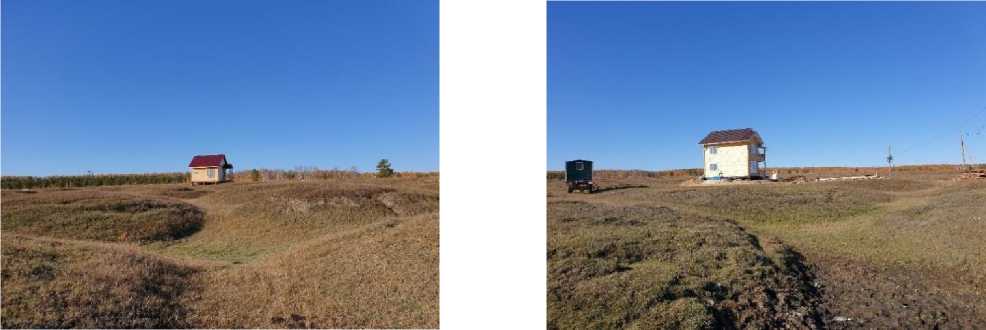
Fig. 20. Fig. 21. Construction of houses in the Neleger micro-district on areas with deeply dissected bylars, Amga, September 2021. Photo by A.A. Suleymanov.
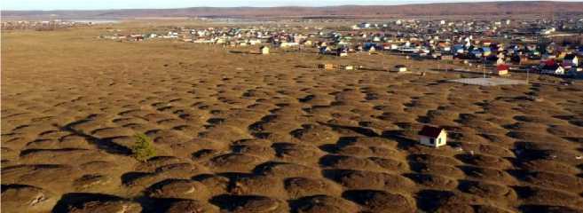
Fig. 22. Construction of houses in the Neleger micro-district on areas with deeply dissected bylars, Amga, September 2021. Photo by A.A. Suleymanov.
Unfortunately, such examples when the population of newly built-up areas in rural Yakutia faces the activation of thermokarst processes are not isolated. In particular, a similar situation is observed in the new Chechir micro-district in the Ulakhan-An village (the population of the village in 2022 was 1132 people), where plots were given primarily to young families with children, as well as in micro-districts unofficially named First, Second, Third and Fourth arable land, located on the territories that used to be allocated for agriculture (Fig. 23–24).
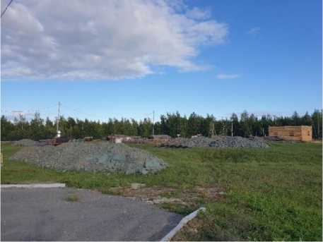
Fig. 23. Construction in the zone of thermokarst processes activation, Chechir micro-district, Ulakhan-An village, August 2022. Photo by A.A. Suleymanov.
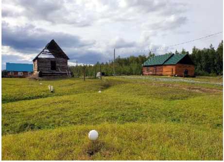
Fig. 24. Building freeze in areas where thermokarst processes have actively developed in recent years, Third arable land micro-district, Ulakhan-An village, August 2022. Photo by A.A. Suleymanov.
The reduction of buildable areas due to the formation of bylars and the flooding of areas due to the degradation of permafrost poses serious problems for the spatial development of Yunkyur, which continues despite the observed population decline. It is bounded on the north, east and west by active thermokarst processes occurring mainly in abandoned pastures, and on the south — by deep ravines.
All these factors affect the cost of construction works due to the need for preliminary backfilling of the territory to create a thermal insulation “cushion”, construction of a piled foundation, as well as location of objects in places difficult to reach from a logistical point of view 18. The increased financial burden also determines the life strategies of villagers who, for example, are forced to continue working instead of retiring in order to pay for the necessary repairs and/or construction of a new house (Fig. 25–26) 19.
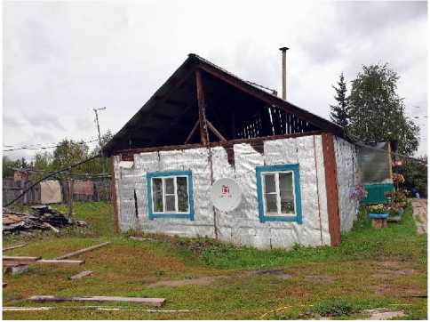
Fig. 25. Consequences of permafrost degradation: the owner of this house had to take a loan for building on a new site and reconsider plans for retirement, Yunkyur,
Fig. 26. Consequences of permafrost degradation: the owner of this house had to take a loan for building on a new site and reconsider plans for retirement, Yunkyur, September 2021. Photo by A.A. Suleymanov.
September 2021. Photo by A.A. Suleymanov.
The burden on local administrations has also increased significantly, as they are forced to carry out additional filling of public areas, solve the issues of resettlement of affected residents and redistribute already limited financial resources for these works, diverting them from other important tasks 20.
Violation of the permafrost temperature regime and “deficit of cold” also affect the traditional economic activities of the population. In particular, cellars and glaciers — structures for storing food, dug in permafrost — are thawing. Thawing leads to a reduction in the period of their use or complete impossibility to use them. In this regard, it is indicative that only 28% of respondents in Amga and 16% in Yunkyur have preserved their glaciers, despite the fact that previously they were “used by everyone” 21. Of course, a significant role was played by the increased stability of electricity supply to rural areas in Yakutia, the growing availability of freezers and the increased supply of products on the market, which made storing large volumes of food unnecessary. At the same time, we have repeatedly noted the fact that glaciers were forced to be abandoned: due to their regular flooding or because they stopped “keeping cold”. In addition, there were cases when cellars were specially buried to prevent degradation of permafrost under the house. According to our sociological survey, 27% of respondents in Yunkyur and 11% in Amga had to resort to such a measure. Large agricultural enterprises also have problems with the preservation of glaciers. In particular, about 5-6 years ago, the glacier of the Amma ACPC (89 m long) in Amga, used in summer for storing meat products, began to flood 22. In Yunkyur, a 50-ton glacier owned by Kladovaya Olekmy LLC was flooded and abandoned 23.
Similarly, permafrost degradation limits the possibilities of agricultural activities both within the personal plots of local residents (22% of respondents in Yunkyur were forced to relocate and/or reduce the size of their vegetable garden) and at the scale of leading actors of agricultural development. Territories affected by thermokarst fall out of agricultural use (Fig. 26–27). In addition to the impossibility of re-commissioning previously abandoned fields, the surface of which has almost completely degraded to bylars, existing fields are also affected. We were able to identify one of the illustrative cases during an interview with the head of an important economic entity in Yunkyur — the Poisk cooperative. Just a day before, a sudden subsidence of soil had occurred under one of its tractors while harvesting crops 24. Another example is related to the activities of Berte Horse Farm LLC in the Khangalasskiy ulus. In addition to similar cases of ground subsidence under agricultural machinery, in recent years the enterprise has been forced to reduce the area of cultivated lands as it becomes impossible to use harvesters due to the active development of thermokarst processes 25.
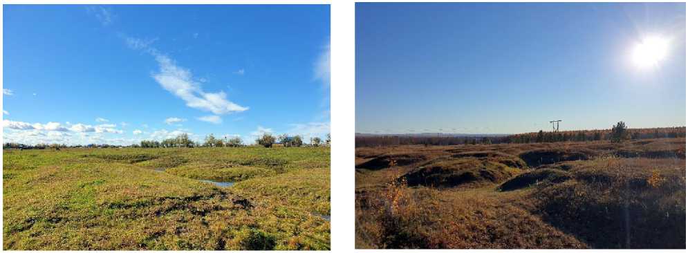
Fig. 27. The territory of former arable lands of the Olekminskiy state farm (Yunkyur village, September 2022). Re-introduction of these lands into agricultural turnover is impossible in the current situation.
Photo by A.A. Suleymanov.
Fig. 28. The territory of former arable lands of the Amginskiy state farm (Amga village, September 2021). Re-introduction of these lands into agricultural turnover is impossible in the current situation. Photo by A.A. Suleymanov.
In the context of the negative impact of permafrost degradation on traditional economic activities, the example of the village of Argakhtakh is even more representative. Founded in the second half of the 1940s as part of the settlement policy and located on the bank of the Alazeya River, this settlement was regularly subjected to floods 26. However, since the 1990s, floods reached catastrophic proportions. The most serious floods were in 2007 and 2017 (Fig. 29–30). In the first case, the water level reached 869 cm, in the second — already up to 897 cm, at a critical level for the village of 782 cm 27. At the same time, unlike transient floods, which are typical for most rivers of Yakutia and last for several days, Alazeya is characterized by a long-lasting rise in water level, which lasts for months. This explains the fact that floods in Argakhtakh can continue for two summer seasons in a row if freeze-up occurs at critically high water levels.
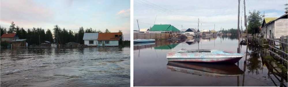
Fig. 29. Streets of Argakhtakh during the flood of 2007. Fig. 30. Streets of Argakhtakh during the flood of 2017. Photo from the museum of the Argakhtakh village. Photo from the museum of the Argakhtakh village.
Permafrost degradation played a significant role in the genesis of modern floods on Alazeya. An increase in seasonal thawing of heavily icy rocks led to an increase in the amount of supra-permafrost groundwater entering the basin of this river [31, Gotovtsev S.P., p. 7].
After the floods, forage grasses did not grow on the flooded agricultural land, because the entire area remained covered with silt. For example, during the last major flood in 2017, 85% of agricultural land and 50% of harvested hay were flooded. As a result, all plots in the vicinity of the village were withdrawn from economic use. The need to exploit more distant lands and to use transport naturally increased the economic burden on economic entities 28. The lack of feed led to the forced slaughter of livestock or the subsequent abandonment of its maintenance due to significant costs and labor inputs. In particular, while in 2015 the population of Argakhtakh kept 139 cattle, in 2019 there were already 87. The number of horses decreased from 477 head to 325 over the same period. In addition, another branch of traditional economic activity — animal farming — came to ought from a figure of 45 heads for the period 2015–2019 29.
An important consequence of the 2017 flood was also the increased transport isolation of Argakhtakh. The village has traditionally been connected to the administrative center of the ulus — Srednekolymskoe — by a stable land connection only in winter time via the Arktika winter road. In summer, an airplane made flights to Argakhtakh. In 2017, the landing site was flooded and damaged so much that it became possible to use only expensive helicopter services. Flights to the village take place twice a month 30.
As a result of permafrost degradation, prerequisites for the deformation of land transport routes are also being created. In this regard, the example of the Lippe-Atakh village is illustrative. Our research has shown that negative cryogenic processes directly within this settlement cover only 5% of all courtyard areas. At the same time, in the vicinity of the village, thermokarst processes are widely observed in anthropogenically disturbed areas, which include lands intended for roads and power lines. Thermokarst landforms are formed here — bylars and duyodyas, the depth of which can reach 3 m, with the thickness of ice-wedge casts up to 5 m. As a result of this, for example, one of the two roads connecting Lippe-Atakh with the Verkhnevilyuysk regional center was taken out of operation (Fig. 30) 31.
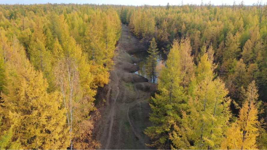
Fig. 31. A section of the former road linking the Lippe-Atakh village and the Verkhnevilyuysk village, September 2021. Photo by V.M. Lytkin.
In Amga and Yunkyur, problems with the safety of communication routes due to permafrost degradation are also observed, but they are much less pronounced (Fig. 32–33). At the same time, respondents in the Yunkyur village reported significant trail deformations and landscape changes within their hunting grounds in the last decade 32. It is difficult to verify this information due to the significant remoteness of these lands from the territory of the village.
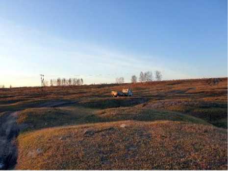
Fig. 32. Examples of deformation of intra-village communication routes in the Yunkyur village, September 2021. Photo by A.A. Suleymanov.
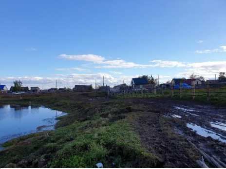
Fig. 33. Examples of deformation of intra-village communication routes in the Chapchylgan village, September 2021. Photo by A.A. Suleymanov.
Peculiarities of perception and adaptation
The ongoing processes have a negative impact on the social well-being of the local population and their confidence in the future (Fig. 34–35). In this regard, the results of the survey are interesting: in Amga, about 53% of respondents identified their own observations as the source of information about climate change, while in Yunkyur — about 75%. At the same time, 62% of respondents in Amga experienced negative manifestations of environmental change and permafrost degradation; in Yunkyur, this figure was 86%. Such answers, as well as the opinions expressed during the interviews, indicate a more sensitive, “acute” perception of permafrost degradation and its consequences on the part of Yunkyur residents than on the part of Amga respondents. The difference is probably due to two main factors: different times of conscious manifestation and the speed of thermokarst processes. The latter, as noted, is somewhat higher in Yunkyur. At the same time, while active thermokarst processes in Yunkyur started closer to the end of the 20th century, in Amga they appeared in the Soviet period, and its inhabitants, accordingly, had more time to adapt and accept them.
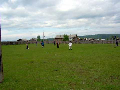
Fig. 34. Sports ground of the Yunkyur Secondary School, 2007.
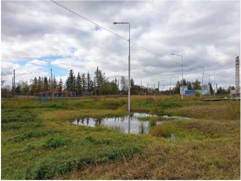
Fig. 35. Sports ground of the Yunkyur Secondary School, September 2022.
Photo by A.A. Suleymanov.
It is indicative that in Ulakhan-Ana, where thermokarst processes entered their active phase only during the last decade and permafrost degradation is an unfamiliar phenomenon for the population, cases of freezing of building for an indefinite period in selected areas were recorded, when visible hollows began to form within its boundaries 33. It is indicative that in Ulakhan-Ana, where thermokarst processes entered their active phase only during the last decade and permafrost degradation is an unfamiliar phenomenon for the population, cases of freezing of building for an indefinite period in selected areas were recorded, when visible hollows began to form within its boundaries) 34.
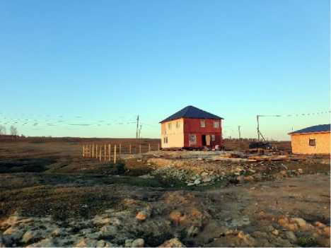
Fig. 36. Construction of houses in areas with active thermokarst processes. According to the owner of the plot, the backfilling in the photo cost more than
300 thousand rubles, Chapchylgan village.
September 2022. Photo by A.A. Suleymanov.
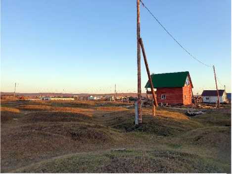
Fig. 37. Construction of houses in areas with active thermokarst processes, Chapchylgan village. September 2022. Photo by A.A. Suleymanov.
In search of answers to the problems that have arisen, representatives of rural communities of Yakutia have developed a number of adaptation mechanisms that make it possible, to a greater or lesser extent, to neutralize the threats associated with the degradation of permafrost.
First of all, this is a change in the construction technology familiar to rural communities of Yakutia. In this regard, preliminary backfilling of sites during the construction of residential buildings has become widespread in order to create a thermal insulation cushion to reduce the heating effect on the soil. It is quite common to build houses on “beds” for these purposes, the role of which can be played by old car tires. Moreover, if the area around the house is regularly cleared of snow, the effect of a ventilated underground arises, which should have a favorable effect on ground freezing. Houses built on pile foundations have also become widespread (Fig. 38–41). The technology of “black” (double) flooring, which goes back centuries, has also acquired new life.
However, if earlier the main purpose of its use was the desire to protect the house from the pene- tration of cold coming from the proximity of permafrost, now it protects the latter from warming up 35.
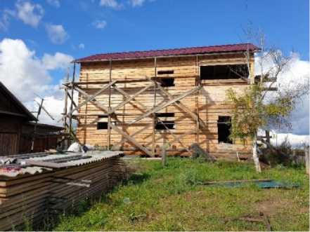
Fig. 38. Adaptation of construction technology to the conditions of permafrost degradation: building a house on old car tires in compliance with the principle of a ventilated underground, Yunkyur, September 2022. Photo by A.A. Suleymanov.
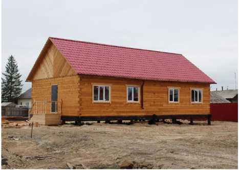
Fig. 39. Adaptation of construction technology to the conditions of permafrost degradation: building a house on a pile foundation, Amga, September 2022. Photo by S.A. Grigoryev.
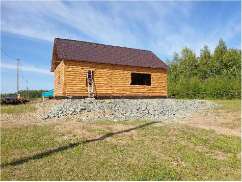
Fig. 40. Adaptation of construction technology to the conditions of permafrost degradation: building a house on a bedrock fill and a metal frame as a foundation, Ulakhan-An, August 2022. Photo by A.A. Suleymanov.
Fig. 41. Adaptation of construction technology to the conditions of permafrost degradation: construction of house foundation on 5-metre larch piles, Ulakhan-An, August 2022.
Photo by A.A. Suleymanov.
The source of information about the advisability of using such technologies seems to be, first of all, the personal experience accumulated by the residents themselves, or, more precisely, living in an environment with quite rich traditions of taking into account the permafrost factor. The phrases “we build like in the city” (where apartment buildings stand on pile foundations) or “like our neighbor” are rather routine explanation for the choice of technology for building new houses, for example, in Amga and Ulakhan-An 36.
At the same time, there is an obvious demand from representatives of rural communities of Yakutia and economic entities to obtain scientifically based data on leveling or preventing possible costs, including, for example, assistance in choosing suitable sites for construction. In this regard, the example of the mentioned company Kladovaya Olekmy is representative. In 2017, they constructed a new farm building in an area of permafrost with low ice content (Fig. 41). According to the information we received from one of the managers of Kladovaya Olekmy during an interview, it was decided to involve qualified specialists in construction in cryolithozone conditions to select the site, given the active thermokarst processes 37. Our research has shown that the territory for the construction of the farm was indeed chosen well 38. Following the recommendations we gave to the management of Malzhagarskiy nasleg, the filling of public areas subject to thermokarst processes started to be carried out in Yunkyur village (Fig. 42) 39. In general, the significant interest of representatives of rural communities of Yakutia in scientifically based data on “interaction” with permafrost, recorded during field research, is a potentially important mechanism for adaptation to emerging challenges.
Fig. 42. Farm building of Kladovaya Olekmy LLC, built on Fig. 43. Backfilling of the area around the club to an area of permafrost with low ice content, Yunkyur, reduce the activity of thermokarst processes,
September 2022. Photo by A.A. Suleymanov. Yunkyur, September 2022.
Photo by A.A. Suleymanov.
However, it should be noted that so far these data have been insufficiently taken into account. In particular, the mentioned orphanage in Yunkyur was built without a ventilated under- ground. The fate of the sixteen-apartment “Experimental house”, built in Amga in 2009 without a pile foundation, turned out to be sad. In 2016, due to critical deformations, a decision was made to resettle its residents. To date, this house has been demolished (Fig. 44–45).
Fig. 44. Remains of the “Experimental house” built without a pile foundation, Amga, September 2021. Photo by A.A. Suleymanov.
Fig. 45. Remains of the “Experimental house” built without a pile foundation, Amga, September 2021 Photo by A.A. Suleymanov.
Other adaptation mechanisms we have identified include the mentioned intensification of the use of land suitable for construction, including denser building, which qualitatively changes the appearance and structure of the settlement. We encountered a situation quite atypical for standard households in rural Yakutia, when a second house for another family — the owner’s relatives — was being built on one plot of land that already had a residential building and several outbuildings.
In this regard, it should be noted that the most important adaptation resource is undoubtedly social relations and traditional collectivism, which is largely inherent in Yakutia’s rural communities. For example, in Argakhtakh, residents of flood-affected areas were able to wait out the disaster for months in the houses of their relatives and fellow villagers located in the higher part of the village 40. In Yunkyur and Amga, residents who are forced to reduce the area of their vegetable gardens can use part of their relatives’ homestead plots. Similarly, the costs of the forced abandonment of glaciers and cellars are compensated to some extent 41. It is obvious that mutual support and strong family ties allow local residents to endure various stressful situations more easily, reduce the threat of desocialization in case of force majeure, and make the life support system of the population of the studied villages more resistant to various shocks [32, Boyakova S .I., p. 220].
Conclusion
Summarizing the data obtained during research in the villages of Amga and Yunkyur villages, it should be noted that thermokarst processes here occur primarily in areas with a developed ice complex, which are characterized by a large anthropogenic load — the territories of the settlements and active economic human activity. In these areas, due to changes in heat balance
NORTHERN AND ARCTIC SOCIETIES
Aleksandr A. Suleymanov, Vasiliy M. Lytkin, Liliya I. Vinokurova, Stepan A. Grigoryev … components and transformation of the climatic regime, thermokarst has rapid dynamics, and its consequences have a diverse impact on the life support system of the population of the villages studied. Degradation of permafrost and thermokarst lead to problems with the preservation of the housing stock, reduction of areas suitable for construction and corresponding restrictions in the spatial development of these villages, as well as transformations in the usual structure of households. In addition, they limit the opportunities for the development of traditional economic practices of local residents, preventing both the potential introduction of additional plots into agricultural turnover and the use of the former ones. The material accumulated to date suggests that these conclusions can be fully extrapolated to Ulakhan-An village.
In general, the first simultaneous cross-section of the current social situation, carried out in rural settlements of 5 administrative districts of Yakutia, which, among other things, differ in natural and geographical location, made it possible to establish that the consequences of permafrost degradation have both their local specifics and significant similarities. In particular, research in the villages of Argakhtakh and Lippe-Atakh made it possible to supplement the picture of the consequences of permafrost degradation with examples of the deterioration of the most important communication routes, which further separates the population already isolated from the main transport communications of the country. The impact of environmental changes on traditional economic activities is obviously most negatively expressed in Argakhtakh, located in northern Yakutia, where the population is a carrier of practices of Arctic indigenous peoples.
As a result, the ongoing transformations negatively affect the social well-being of villagers and influence their life strategies. Leveling of the costs arising from permafrost degradation and ongoing thermokarst processes entail a corresponding increase in the financial burden on the population, economic entities and local administrations. The material revealed allows us to conclude that there are certain features of perception of ongoing changes in the usual state of the environment and response to them, which, in our opinion, are determined, first of all, by different times of manifestation and the speed of permafrost degradation within and around the studied settlements. At the same time, the existing and apparently developing set of adaptation mechanisms, as well as the results of a questionnaire survey conducted during our research, showed that only less than 15% of respondents would like to move to another settlement in case of permafrost degradation continues, together with the personal observations of the project participants, seem to indicate a certain stability of the existing life support systems of rural communities in the region to emerging natural challenges.
References Rural Communities of Yakutia in Conditions of Permafrost Degradation: Key Risks, Social Consequences, and Adaptation Mechanisms
- Suleymanov A.A. Antropologiya kholoda: estestvennye nizkie temperatury v traditsionnoy sisteme zhizneobespecheniya yakutov (XIX v. — 30-e gg. XX v.) [Cryoanthropology: Influence of Natural Low Temperatures on the Yakut Traditional Life Sustenance System, 19th Century to the 1930s]. Oriental Studies, 2021, vol. 14, no. 1, pp. 115–133. DOI: 10.22162/2619-0990-2021-53-1-115-133
- Shestakova A.A., Fedorov A.N., Torgovkin Y.I., Konstantinov P.Y., Vasyliev N.F., Kalinicheva S.V., Samsonova V.V., Hiyama T., Park H., Iijima Y., Iwahana G., Gorokhov A.N. Mapping the Main Characteristics of Permafrost on the Basis of a Permafrost-Landscape Map of Yakutia Using GIS. Land, 2021, no. 10 (5), p. 462. DOI: 10.3390/land10050462
- Skachkov Yu.B. Dinamika izmeneniya srednegodovoy temperatury vozdukha v respublike Sakha (Yakutiya) za poslednie 50 let [Mean Annual Air Temperature Variation in the Republic of Sakha (Yakutia) During the Last 50 Years]. In: Trudy Devyatogo mezhdunarodnogo simpoziuma «Balans ugleroda, vody i energii i klimat boreal'nykh i arkticheskikh regionov s osobym aktsentom na Vostochnuyu Evraziyu» [Proc. 9th Intern. Symposium "C/H2O/Energy Balance and Climate over the Boreal and Arctic Regions with Special Emphasis on Eastern Eurasia"]. Yakutsk, Russia. Nagoya, Nagoya University Publ., 2016, pp. 208–211. (In Russ.)
- Suleymanov A.A. «Resursy kholoda» v sisteme zhizneobespecheniya sel'skikh soobshchestv Yakutii. Vtoraya polovina XIX–XX v.: monografiya ["Cold Resources" in the Life Support System of Rural Communities of Yakutia. The End of the 19th - the Beginning of the 20th Century]. Novosibirsk, Nauka Publ., 2022, 136 p. (In Russ.)
- Efimov G.F., Grave N.A. Pogrebennye l'dy rayona ozera Abalakh [Buried Ice of the Abalakh Lake Area]. Sotsialisticheskoe stroitel'stvo [Socialist Construction], 1940, no. 10–11, pp. 67–78.
- Fedorov A.N., Konstantinov P.Y., Vasilyev N.F., Shestakova A.A. The Influence of Boreal Forest Dynamics on the Current State of Permafrost in Central Yakutia. Polar Science, 2019, vol. 22, р. 100483. DOI: 10.1016/j.polar.2019.100483
- Shur Y., Hinkel K.M., Nelson F.E. The Transient Layer: Implications for Geocryology and Climate-Change Science. Permafrost and Periglacial Processes, 2005, vol. 16, no. 1, pp. 5–17. DOI: 10.1002/ppp.518
- Grosse G., Romanovsky V., Jorgenson T., Anthony K.W. Vulnerability and Feedbacks of Permafrost to Climate Change. Eos, Transactions American Geophysical Union, 2011, no. 9 (92), pp. 73–74. DOI: 10.1029/2011EO090001
- Kachurin S.P. Termokarst na territorii SSSR [Thermokarst on the Territory of the USSR]. Moscow, AS USSR Publ., 1961, 262 p. (In Russ.)
- Fedorov A.N., Gavriliev P.P., Konstantinov P.Y., Hiyama T., Iijima Y., Iwahana G. Estimating the Water Balance of a Thermokarst Lake in the Middle of the Lena River Basin, Eastern Siberia. Ecohydrology, 2014, no. 2 (7), pp. 188–196. DOI: 10.1002/eco.1378
- Streletskiy D.A., Suter L.J., Shiklomanov N.I., Porfiriev B.N., Eliseev D.O. Assessment of Climate Change Impacts on Buildings, Structures and Infrastructure in the Russian Regions on Permafrost. Environmental Research Letters, 2019, no. 2 (14), p. 25003. DOI: 10.1088/1748-9326/aaf5e6
- Motenko R.G., Lupachev A.V., Tananaev N.I., Shepelev A.G. Vliyanie degradatsii mnogoletney merzloty v Tsentral'noy Yakutii na soderzhanie organicheskogo ugleroda v pochvakh i verkhnikh sloyakh MMP [Impact of Permafrost Degradation in Central Yakutia on Organic Carbon Content in Soils and Upper Layers of Permafrost]. In: Monitoring v kriolitozone: Sbornik dokladov Shestoy konferentsii geokriologov Rossii s uchastiem rossiyskikh i zarubezhnykh uchenykh, inzhenerov i spetsialistov [Monitoring in Cryolithozone. Collection of Reports of the 6th Conference of Geocryologists of Russia with the Participation of Russian and Foreign Scientists, Engineers and Specialists]. Moscow, KDU Publ., Dobrosvet Publ., 2022, pp. 1074–1079. (In Russ.)
- Sannikova E.E., Evstafyeva S.V., Tananaev N.I., Danilov I.V., Artamonov I.A. Vliyanie lesnykh pozharov na degradatsiyu mnogoletney merzloty [Impact of Forest Fires on Permafrost Degradation]. In: DIGITAL EDU. Tsifrovye kompetentsii v obrazovanii: Sbornik materialov Vserossiyskogo nauchnogo foruma s mezhdunarodnym uchastiem [DIGITAL EDU. Digital Competences in Education: Proc. . All-Russ. Sci. Forum with International Participation]. Kirov, MCITO Publ., 2022, pp. 271–274. (In Russ.)
- Melnikov V.P., Osipov V.I., Brushkov A.V., Badina S.V., Drozdov D.S., Dubrovin V.A., Zheleznyak M.N., Sadurtdinov M.R., Sergeev D.O., Okunev S.N., Ostarkov N.A., Osokin A.B., Fedorov R.Yu. Adaptatsiya infrastruktury Arktiki i Subarktiki k izmeneniyam temperatury merzlykh gruntov [Adaptation of Arctic and Subarctic Infrastructure to Changes in the Temperature of Frozen Soils]. Kriosfera Zemli [Earth’s Cryosphere], 2021, vol. 25, no. 6, pp. 3–15. DOI: 10.15372/KZ20210601
- Zhirkov A., Permyakov P., Kirillin A., Wen Z. Influence of Rainfall Changes on the Temperature Regime of Permafrost in Central Yakutia. Land, 2021, vol. 10, no. 11, p. 1230. DOI: 10.3390/land10111230
- Lytkin L.V., Syromyatnikov I.I. Application of an Unmanned Aerial Vehicle for Large-Scale Mapping of Thermokarst Landforms. IOP Conference Series: Earth and Environmental Science, 2021, vol. 666, p. 062030. DOI: 10.1088/1755-1315/666/6/062030
- Saito H., Iijima Y., Basharin N.I., Fedorov A.N., Kunitsky V.V. Thermokarst Development Detected from High-Definition Topographic Data in Central Yakutia. Remote Sensing, 2018, no. 10, p. 1579. DOI: 10.3390/rs10101579
- Shiklomanov N.I., Streletskiy D.A., Swales T.B., Kokorev V.A. Climate Change and Stability of Urban Infrastructure in Russian Permafrost Regions: Prognostic Assessment Based on GCM Climate Projections. Geographical Review, 2017, no. 1(107), pp. 125–142. DOI: 10.1111/gere.12214
- Doloisio N., Vanderlinden J.-P. The Perception of Permafrost Thaw in the Sakha Republic (Russia): Narratives, Culture and Risk in the Face of Climate Change. Polar Science, 2020, no. 26, p. 100589. DOI: 10.1016/j.polar.2020.100589
- Svinoboev A.N., Neustroeva A.B. Izmenenie klimata i usloviy zhizni na Severe v vospriyatii korennogo naseleniya [Changes in Climate and Living Conditions in the North as Perceived by Indigenous People]. Urbanistika [Urban Studies], 2017, no. 4, pp. 28–39. DOI: 10.7256/2310-8673.2017.4.24619
- Fujiwara J. Flood Risk and Migration in the Republic of Sakha (Yakutia). In: Global Warming and Human — Nature Dimension in Northern Eurasia. Singapore, Springer, 2018, pp. 125–143. DOI: 10.1007/978-981-10-4648-3_8
- Ananicheva M.D., Litvinenko T.V., Filippova V.V. Izmenenie klimata v Respublike Sakha (Yakutiya) i ego vliyanie na naselenie: instrumental'nye izmereniya i nablyudeniya mestnykh zhiteley [Climate Change in the Republic of Sakha (Yakutia) and Its Impact on the Population: Instrumental Measure-ment and Observations of the Local Population]. Geograficheskaya sreda i zhivye sistemy [Geo-graphical Environment and Living Systems], 2021, no. 3, pp. 6–21. DOI: 10.18384/2712-7621-2021-3-6-21
- Takakura H., Iijima Y., Ignatieva V.B., Fedorov A.N., Goto M., Tanaka T. Permafrost and culture. Global Warming and the Republic of Sakha (Yakutia), Russian Federation. Tohoku, Center for North-east Asian Studies, Tohoku University, 2021, 60 р.
- Takakura H., Fujioka Y., Ignatyeva V., Vinokurova N., Grigorev S., Boyakova S., Tanaka T. Differences in Local Perceptions about Climate and Environmental Changes among Residents in a Small Com-munity in Eastern Siberia. Polar Science, 2020, no. 27, pp. 100556–100630. DOI: 10.1016/j.polar.2020.100556
- Solovyev P.A. Kriolitozona severnoy chasti Leno-Amginskogo mezhdurech'ya [Cryolithozone of the Northern Part of the Leno-Amginsky Interfluve]. Moscow, AS USSR Publ., 1959, 144 p. (In Russ.)
- Safronov F.G. Russkie na severo-vostoke Azii v XVII — seredine XIX v.: upravlenie, sluzhilye lyudi, krest'yane, gorodskoe naselenie [Russians in Northeast Asia in the 17th — mid-19th Centuries: Management, Service People, Peasants, Urban Population]. Moscow, Nauka Publ., 1978, 258 p. (In Russ.)
- Fedorov V.V. Istoriya Amginskogo ulusa v datakh [History of Amginsky District in Dates]. Yakutsk, Poligrafist Publ., 1996, 92 p. (In Russ.)
- Redko M.A., Kulagin Yu.D., Pavlyak A.F., Gorizontov V.V., Gorizontova T.M., Kuzmina F.I., Kostenko S.A. Yunkyurskiy nasleg [Yunkyur Nasleg]. Olyokminsk, Central district library Publ., 2010, 24 p. (In Russ.)
- Ugarov I.S., Efremov P.V. Monitoringovye issledovaniya sel'skokhozyaystvennykh landshaftov v Tsentral'noy Yakutii [Cryoecological Monitoring Investigations of Agricultural Landscapes in Central Yakutia]. Uspekhi sovremennogo estestvoznaniya [Advances in Current Natural Sciences], 2011, no. 9, pp. 23–26.
- Lytkin V.M. Temperaturnyy rezhim mnogoletnemerzlykh porod na uchastkakh proyavleniya termo-karstovykh protsessov [Temperature Regime of Perennially Frozen Rocks in the Areas of Thermo-karst Processes Manifestation]. In: Geologiya i mineral'no-syr'evye resursy Severo-Vostoka Rossii: Materialy XII Vserossiyskoy nauchno-prakticheskoy konferentsii [Geology and Mineral Resources of the Northeast of Russia. Proc. 12th All-Russ. Sci. and Pract. Conf.]. Yakutsk, NEFU Publ., 2022, pp. 424–427. DOI: 10.52994/9785751332846_2022_89 (In Russ.)
- Gotovtsev S.P., Kopyrina L.I., Efimova A.P., Zakharova V.I., Nogovitsyn D.D., Poryadina L.N., Zabolot-nik P.S., Syromyatnikov I.I., Ivanova A.Z., Egorov N.N., Desyatkin R.V., Okhlopkov I.M., Ivanova E.I., Mikhaleva L.G., Kirillin E.V., Gabysheva O.I., Salova T.A., Kilmyaninov V.V. Krioekosistemy basseyna reki Alazei: monografiya [Cryoecosystems in the Alazeya River Basin]. Novosibirsk, Geo Publ., 2018, 210 p. (In Russ.)
- Boyakova S.I., Grigoryev S.A., Takakura H., Fudzhioka Y. Sel'skie poseleniya Yakutii v usloviyakh iz-meneniya klimata: strategii adaptatsii k degradatsii vechnoy merzloty [Rural Settlements of Yakutia in the Face of Climate Change: Strategies for Adapting to the Degradation of Permafrost]. In: Pravo v kontekste ustoychivogo razvitiya Arktiki: vyzovy vremeni i novye vozmozhnosti: sbornik materialov mezhdunarodnoy nauchno-prakticheskoy konferentsii [Law in the Context of Sustainable Develop-ment of the Arctic: Challenges of Time and New Opportunities: Proc. Intern. Sci. and Pract. Conf.]. Kazan, Buk Publ., 2021, pp. 216–221. (In Russ.)
