To the question about the Northern Sea Route in the history of the Polar expedition of V. Rusanov

Author: Zobnin A.N.
Journal: Arctic and North @arctic-and-north
Section: History
Article in issue: 8, 2012.
Free access
The article describes the stages of formation and development of the ideas of the famous polar explorer, geologist V. A. Rusanov, which formed the basis of the plans of his last expedition in 1912. Based on Russian Arctic expeditions in 1909−1915 period (including the 1st and 2nd New Zemlians), and modern data on the Arctic navigation and weather conditions of the Kara Sea, the author puts forward and often justified the route cutter version ‛Hercules’ to the shores of the Taimyr autumn of 1912, winter 1912−1913 and the return trip to navigation in 1913.
Expedition, Rusanov, ice, Kara Sea, the Arctic, Novaya Zemlya, Hercules, cape, highlatitude, Siberia, Yenisey, Desires, ball, path, way, Taimyr, wintering, Minins’ sherries Gulf Pyasinskaya, currents, the East, parking, island , geology, and hydrology
Short address: https://sciup.org/148320409
IDR: 148320409 | UDC: 910.4
Text of the scientific article To the question about the Northern Sea Route in the history of the Polar expedition of V. Rusanov
Stubbornly go ahead in the risk of losing people and animals - that I can not allow that. If you want to win the game, we must act wisely.
From the diary of R. Amundsen
For already a century, the image of the ice schooner of the boundless expanses of the Arctic is haunted by the romantics and serious scientist. Millions of boys and girls brought up the example of the heroes of the polar trips, they read "to the holes" the novel by Kaverin "Two Captains". The motto carved on the memorial plate to R. Scott, "Fighting and finding, found and never bring up", and it became the life motto.
Past goes farther, covered with legends and various suggestions, and in many ways the participants of the events appear to us lifeless images, raised an enthusiastic crowd to its highest pitch, or thrown into the most remote corners of the human mind. And yet, they were ordinary people with their vision goals and ways to achieve them. And the challenge to show their commitment in a variety of real human life. See their real actions and understand their mistakes.
* * *
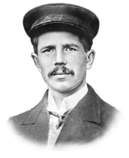
July 9, 1912 at 9:00 pm motor sailing cutter "Hercules" left the harbor of St. Catherine. "The captain was at the helm ..." Goodbye. Goodbye. Happily "- were from all sides. "Forward!" - Has ordered the captain. Methodically earned a motor. "Cheers" - a sudden there was on the beach, followed by a shot from guns. What greeted us crowd, accumulated on the shore. We, in turn, saluted the flag and inferior volleys of our rifles. The latter sent us the greetings from Alexander Biological Station ... "1. These lines from the diary of the participants in those events of R.L. Samoilovich left us the only documentary evidence of the beginning of one of the most mysterious expeditions of the XX century – the Arctic expedition of Vladimir Alexandrovich Rusanov.
According to the scenario of the standard version, the autumn of 1912 the schooner "Hercules" for the first time in the history of the Northern Sea Route was from the Barents Sea to the mouth of the Yenisei River, skirting the north Cape Desire. Almost all researchers, referring to the well-known articles on the subject of Rusanov and his last letter, agree that the purpose of the expedition was the search of the high road to the east.
Indeed, in recent years Rusanov devoted to this problem, the solution of which, he believed, will give an unprecedented jump in the development of Arctic navigation and the economic growth of Siberian regions. On what is based the beliefs of B. Rusanov, by then he was the sufficiently experienced polar explorer? To clarify this question it is necessary to turn to the history.
In antiquity go first attempts to connect Europe and Asia via Northern Sea Route. And it is unlikely to be correctly identified here an historic championship before the start of the Great Northern Expedition, the proceedings of which were the basis of Russian national interests in the Arctic.
Considerable length and heavy ice conditions of the sailing to the east along the coast have created a wide variety of assumptions about the high latitude, and consequently, a shorter route to the coast of Siberia.
The first Russian scientific basis of the the possibility of such routes to the East was in the XVIII century, by Mikhail Lomonosov. The great Russian scientist, by leading a number of physical and geographical evidence of the summer melting of the ice in the Arctic, was convinced that "... the sun, though indirect rays whole shines almost constantly for six months, and can not warm him."
"On the eastern side of Shpizbergen - he wrote - the ice can not go to the coast of the three or four hundred miles stretch, hence in half and at the end of July, should the North by a new ocean between the Novaya Zemlya and Spitzbergen be clean and ice-free, and that meter pure ocean stretch far away to the east on the ice without a small measure for a thousand miles. These things should be a clean place to a width of about 80 degrees, from the Siberian coast about 600 miles. "On this basis, Lomonosov believed that swimming the most convenient way from the northern tip of Novaya Zemlya to the Chukotka Peninsula "... away from the Siberian coast for five and seven hundred miles Siberian Ocean in the summer months... "2
Opinions about the ice-free seas of the circumpolar space long held among the geographers and navigators. Some cause for this view could give the so-called Siberian polynya, located in two hundred miles north of the New Siberian Islands. Here, even in the winter the sea is covered with moving ice, and sometimes completely free of ice. More about this polynya in 1822 reported Gedenshtrom, believed that the north of the 76th parallel is "the Northern ocean, never freezing."
In 1870, the famous German geographer A. Peterman wrote that in high latitudes should be ice-free seas. Russian geographer A. Voeikov also suggested the presence of free water to the north of the Siberian coast. December 18, 1870 at the meeting of the Geographical Society, during the defending of the project of the Arctic expeditions "for the study of the Novaya Zemlya along the northern coast of Siberia to the Bering Strait," he said, referring to Gedenshtroma and Wrangel, which north of the New Siberian polyn-ya finds more, said: "In the evidence, I have reasons to believe the continued of the Golfshtroma the east of New Earth "3.
In November 1901, D.I. Mendeleev presented Witte memorandum "On the study of the Arctic Ocean." The great Russian chemist also expressed the belief that in the central part of the polar basin at least half of the surface is free water, and designed to pass through the Bering Strait to the North Pole. "I wish the truth, that is with the ships, victory over the polar ice - he wrote - Russia to an even greater extent than any other state, because none of them has such a large stretch of the coast of the Arctic Ocean, and here it pouring huge river, washing the greatest part of the empire, not only being able to develop not so much on the climatic conditions as due to lack of trade outlets across the Arctic ocean "4.
Base to its assumptions of A. Voikova and D. Mendeleyev were wrong, because the relatively heavy and salty waters of Gulf Stream in the central parts of the Arctic Ocean sink to the depths, covered with layers of cold currents, and the cause of the Siberian polynya can not be.
Original proof of such conclusions in the Barents Sea was hydrological studies of the materials science in the Murmansk fishing expedition (MNPE) in 1898-1908 periods. Led initially N. Knipovich, then LL Breyfusom, expedition for ten years conducted a comprehensive study of the Arctic waters, combining academic research and applied research. One of the most important results of many years of work was a monograph N. Knipovich "Fundamentals of Hydrology of the European Arctic Ocean," published in 1906. He submitted the hydrological regime in the Barents Sea, with minor amendments, is relevant to this day.
Powerful stream of warm Norwegian current as it moves to the east is divided into coastal and northern flow (Pic. 1). Meridians of the Kola Bay of the waters of the Coastal branch deviates to the southeast, moving along the coast of the Kola Peninsula, and goes to the White Sea. Another part of the coastal currents should be in the north-east, forming Murmansk current, and under the name "Zemlya" reaches Matochkina Bowl. The northern branch of the Norwegian current on the 30th meridian, separating the north-eastern, eastern and south-eastern branch is included in the general cyclonic circulation of the Barents Sea.
These and other studies formed in the basis of the greatest achievements of XX century - the practical use of the Northern Sea Route.
At the end of the war with Japan, the problem of the rapid delivery of goods to Siberia and the Far East North Sea has been raised to the height of the public interest. In 1906 starts the second state commission on the development of the Northern Sea Route, whose efforts produced the second Hydrographic Expedition of the Arctic Ocean and built icebreaking ships "Taimyr and Vaigach." One member of the commission, the famous explorer of the Arctic seas AI Varnek, in his work "The distribution of ice and navigation conditions on the sea route to Siberia," noted that "the conditions for navigation in high latitudes, not excluding the way around the northern tip of the New Earth, which yet not go any steamship, at least no worse than the way the southern straits, and can be, will be made when monitoring in the polar ice on this northern road, this will be the last and the best. "
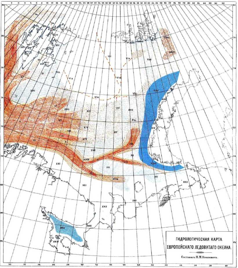
Pic. 1. The hydrological map of the Barents Sea. Created by N.M. Knilovichem
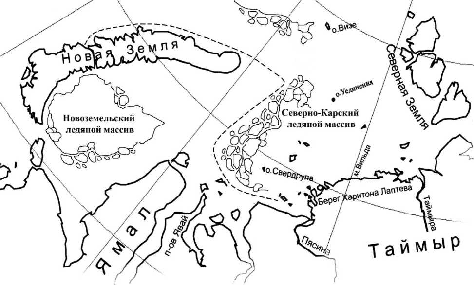
It is difficult to say when the first idea of the Northeast Passage high latitudes captured Rusanov. Certainly it was no later than in 1909 - the time of his participation in the 1st Zemlya expedition.
The expedition by I.V. Sosnovskiy should held the researchers of the Novaya Zemlya in the colonization manner.
In the two months, in the period between the steamship flights, the expedition was instructed to gather the necessary information to select the location for the new encampment and plan further studies of the northern island. The head of the expedition was appointed - V. Kramer, an expert on the use of mineral resources of the Arkhangelsk province.
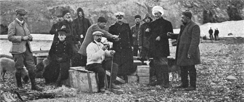
The participants of the first Novezemelskayas expedition with Arkhangelsk governor
V.A. Rusanov was invited as a geologist. His part in the French expedition of Charles Benard in 1908 was a good reference for the organizers of the Russian expedition of 1909.
Without making stops on the details in the materials of the company, it should be noted Rusanova initiatives in the research, which first took place in this part of the New Earth. Even then, not limited to the geological research, he studied paleontology, glaciology, hydrology, and with particular enthusiasm of the hydro meteorological research what would become the main focus in the formation of his designs. Expanding its research program, Rusanov collected material, which later formed the basis of his views on the prospects of the Arctic regions. These included observation since the French expedition in 1907, the discovery of glass spheres and buoys off the west coast of Novaya Zemlya (the 75th parallel), the priest, in his view, from the south of the Norwegian lighthouses, and, of course, contact with Zemlya Samoyeds, in his opinion, one of the most reliable sources on the climatological processes of the Kara and Barents Seas. Peculiar, sometimes similar to the legend, the residents of the colony Samoyed later enter the basis of his evidence.
That's when the first conclusions to be made about the effect of the warm currents in the hydrological situation waters adjacent to the New Earth.
On the arrival to Archangelsk, Rusanov turned violent activity by the wide coverage of the research, and not only those areas that are related to geology. Mass of new ideas, acquired in the expedition, needed a way out. Its non-core education topics, familiarity with which, admittedly, was superficial, as reflected in the pages of newspapers and magazines. We must not forget - it was the beginning of XX century, when the narrow-minded interest in everything new, the unknown was higher than ever before, especially with respect to the polar so fired up by the world press. Race to the pole, arctic adventures were on the front pages of newspapers and journal of this time.
Rusanov, like many of his contemporaries, captured by the Arctic fever, could not be away from this problem. His quick mind and irrepressible energy demanding tasks larger scale. By the time the first task of the state in the Arctic became the Northern Sea Route. Progress in this direction is the most lively response of the authorities and the public. And here it is used to its diversified research, which, in his opinion, is directly related to the problems of Arctic shipping from the Barents Sea to the coast of Siberia.
In 1910, in St. Petersburg, under the redaction of the Arkhangelsk Governor I.V. Sosnowski published "Materials on the study of the New Earth", edition I. Summing up the results of the expedition in 1909, Rusanov brings unprecedented scale, the idea of "fast and risk-free trade ties with Siberia."
In his article "Is it possible the urgent shipping between Arkhangelsk and Siberia across the Arctic Ocean?" He first outlined the range of problems the solution of which can be in the coming years to open new Arctic journey. "Up until now, - wrote Rusanov - with unwavering tenacity and confusing trying to go to Siberia through the Kara Sea, skirting or New Earth or Vaigach possibly south: via Yugorsky through Kara Gate, more rarely through Matochkin. I suggest just the opposite. I propose to skirt the New Earth as much as possible to the north, and the Kara Sea is left apart. "To substantiate his proposals, he pointed out that "... an extended, slow and chilled, but still relatively warm, it should go round for the New Earth, once again leaning toward the east, it moves slowly over the polar ice from the northern coast of Siberia to Greenland
"(Pic. 2).
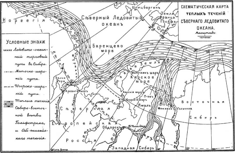
Pic 2. Map of warm currents, composed of V.A. Rusanov to the article "Is it possible the urgent shipping between Arkhangelsk and Siberia across the Arctic Ocean?"
And, quite interesting in the development of the global ideas given in this regard, it is erroneous explanation Transpolar Drift ice, "If a broad and warm over the Atlantic Ocean to the west of the envelope is not a New Earth, it would be quite inexplicable laws of motion of a mechanism of permanent ice of the Arctic Ocean5.
Here you can see that V. Rusanov was full of ideas, which was based on the same theory of all branches of the warm Gulf Stream on the northern tip of Novaya Zemlya and the northern part of the Kara Sea. It should be noted that it offers, without having to date, no scientific evidence, were more in the na- ture of speculation and built by his own admission, the "based on a critical review of the literature the question of maritime trade route to Siberia, based on practical observations and theoretical considera-tions.»According to the articles and speeches of the period, he sought to independently identify the problem, and as far as possible to express it.
For the final presentation of the project, believed Rusanov, lacking only the materials of hydrological research area adjacent to the northern end of the New Earth. "We need to keep in mind - he wrote -that the direction of flow in the northern part of the New Earth is still unexplored and that my views on this matter are hypothetical. That's why asking this fundamental question, in my opinion, should make the most important task of the expedition to Novaya Zemlya in 1910. This expedition will have to finally clear up the question of how useful my proposed trade route to Siberia. But for this it is not only needed to rise to the most extreme northern point of Novaya Zemlya, to Cape Desire, and round it. If the expedition will have positive results, then in 1911 it will be possible to make the first test flight from Arkhangelsk to the Yenisei to the new ocean-ice cover of the way "6.
In the summer of 1910 was equipped the 2nd Novozemelskaya expedition. Program of the expedition, made by V. Rusanov (now the head of the expedition), included the continued examination of the northwest coast of Novaya Zemlya Peninsula Admiralty to Arkhangelsk lips, started in 1909. In addition it was assumed if time and circumstances to try to pass around the northern tip of the island. Rusanov for it was an opportunity to present all the necessary materials for a thorough review of the possible directions of Arctic shipping from the Barents Sea to the coast of Siberia.
In the middle of August in 1910 the two-masted sailing-motor cutter "Demetrius of Thessalonica" approached the north-western tip of the New Earth. By the time, the expedition of Rusanov conducted the extensive research to the west coast of the island. Since that time, was to begin the study, which formed the basis for completely new concepts of the Arctic navigation. In the report "On" Demetrios "around the New Earth. Description Zemlya Expedition 1910 ", published in St. Petersburg in 1911, is presented, in fact, the diary Rusanov," August 16. Rounded Cape Desire and came close to the yellow ground with overhanging cliffs above the sea, but again blew a fresh wind, which forced to go to sea again. Hove to and took a new hydrological series to the 20 kilometers of the north-east of Cape Desire .
Pic 3. The northern end of the New Earth. The route of the cutter "Dmitriy Solunskiy," August - September of 1910. Fragment of the map, drawn by V.A. Rusanov
August 17. Rusanov invited the captain to go even further to the north-east to take third in the series of hydrological sphere, and in never before explored area. At 2 pm went into the hove for working in 55 kilometers to the north-east of the Cape Desire. The depth here was so great that the lot, dropped to 200 meters, not pulled out of the bottom. Unfortunately, the longer spare tench were not aboard, so learn the true depth was not possible. While lots of waters were taken from NNO on the horizon ice. It was the first marine polar ice, the expedition encountered at sea. The ship went straight to the ice and reaching a 77 ° 24 North. wide. band much broken ice, which stretched from east to west, to the right along it, avoiding some places large blocks of ice. Passing, so about 50 miles to the west, they saw that the ice is wrapped to the north. Then turned back to the south and anchored on the east side of Cape Desire.
Thus, on the traverse of the Cape of Dreams was made only one hydrological cut with the length about 50 km (pic. 3).
"On 18 August, around midnight," "Dmitriy Solunskiy," "weighed anchor and went along the eastern coast of Novaya Zemlya to the Gulf in the icy of the Barents harbor. By the evening of the same day landed, from a high place to see coastal ice. When the members of the expedition went up the hill, around the Ice Harbor, we saw that the south-east all the Kara Sea from the shore to the horizon was covered with solid ice, and, despite a strong wind blowing from the shore, the ice that was still off the coast. Thus, the path to the south was cut off. It seemed impossible to go beyond the Kara Sea. But to the east, where the eye could reach, the sea was completely free of ice. It remained one of two things: either return the same way you came here, that is, the Barents Sea, which did not want to Rusanov, or try to get around the counter ice, heading east.,7.
August 19 "Dmitriy Solunskiy," holding near the edge of the ice, passed to the east about 70 km, but the strong wind with snow forced to escape from a dangerous neighborhood with ice. Captain in the absence of visibility headed the northwest and back to the Cape of Desires. The whole next day and night was the storm. Strong wind filled the Orange Island ice, and out into the Barents Sea has been closed. August 21 team anxiously watched the approaching from the northwest to the ocean is vast fields of ice. The threat of loss of the vessel, pressed against the shore, was evident. The only salvation was a narrow channel along the northeast coast, the resulting shift of the ice under the pressure of the west wind. Inching along convergent and divergent channels south along the east coast of Novaya Zemlya, "Dmitriy Solunskiy," On August 27 went to Matochkin Bowl.
The participants of the second Novozemelskoy expedition with Arkhangelsk governor
7 On «Dmitriy Solunskiy» and around Novaya Zemlya. The description of Novozemelskoy expedition 1910. Spb. 1911.
This is a fairly detailed description of a few days of the expedition at the northern end of Novaya Zemlya gives us a great number of very important facts that will help us to understand the development of ideas of V. Rusanov and evaluate his further conclusions. These materials were determinant in the analysis of his latest expedition.
Without a doubt, the 2nd Novozemelskaya expedition amended few changes in the understandings of V. Rusanov about the high latitudes ways to Siberia, and it became the most important and crucial step in the formation of his scientific views. A few days at sea near the Cape of Desires, gave an opportunity to see the complexity of the processes, which had been taking place there and took a fresh look at his problem. The change in his beliefs to a more moderate conclusions about alternative ways of the Arctic evident in his works.
Together with a description of the sailing of "Dmitriy Solunskiy" around the northern tip of Novaya Zemlya in 1911, it was published the final article of V. Rusanov "To the question about the northern sea route to Siberia," in which he presented all the accumulated his thoughts on this subject. It should be especially noted that this, in many ways contradictory, work displayed the fight of V. Rusanov with his old ideas and with new realities for him.
Admitting that "for lack of a more accurate and extensive observations in captivity, so we have to use poor materials, which we have « but he, nevertheless, questioned the long-term hydrological research materials of Murmansk scientific fishing expedition. His critical assessment of the research work of N. Knipovich about the hydrological regime of the Barents Sea, which is already built by not on the temperature characteristics, which Rusanov has extremely small, and by his suggested kinetic regime of water masses. Referring here on the historical sources of the previous expeditions (drift of "Tegetgofa"), stories of Samoyeds, own observations and suggestions and Rusanov tried to arguebut he didn’t have scientific basement. He asked, "how couldn’t see Golfstrema the Murmansk scientific-commercial expedition, which had in its major scientific powers and the means to enjoy the large multi-year extension of their work," and explained it to the researchers, by measuring the temperature and salinity of the water layers, left ignore the dynamics of the Gulf Stream cooled branches, which, according to Rusanov are the reasons of Kara po-lynya. "With the decreasing of the temperature of Golfstrema - he wrote - with decreasing of its calorific energy, it doesn’t mean the decreasing of its its mechanical strength, its ability does not disappear with them take the ice to the north and to clear the way to Siberia, around the northern tip of Novaya Zemlya, around the Cape of Desires"8.
Even the most superficial comparison of the hydrological materials of Murmansk scientific fishing expedition and the 2nd Novozemelskaya expedition becomes clear their incommensurability in the amount of the scientific data. According to the whole historical significance of sailing of "Dmitriy Solunskiy" around the northern tip of Novaya Zemlya, the main goal of the expedition - was"... to clarify the question of how useful the proposed trade route to Siberia" – it was not achieved. Ice conditions did not allow to held, which are necessary in this case, research waters surrounding of the northern tip of the island. One 50-kilometer hydrological incision to the northeast of Cape of Desires, on which is referenced V. Rusanov in his work, it was not enough to make a definite conclusion about the impact of the Gulf Stream on the ice conditions of the north of the Kara Sea.
It is now known that the currents in the Barents Sea play the most important role. During the navigation period along the Northern Sea Route, the chose of the best course from the Cape Desire to island Dixon determined by the position of the North Kara and Novaya Zemlya ice masses. If the prevailing northerly winds and the intensity of the Ob and Yenisei flow is insufficient, the ice of the North Kara ice massif held west of the Sverdrup Islands and Novaya Zemlya ice massif moves to the south along the east coast of the island of Novaya Zemlya. Dominated of the southern winds, the ice flow away by Ob-Yenisei to N9.
But, despite of the criticism to the modern science, V. Rusanov realizes that his former statements have very little to do with reality. Recalling his recent performances and more well-known article "Is it possible to have urgent shipping between Arkhangelsk and Siberia? » He admits that before, when he was "not quite yet understand the complexity and originality of the organization of the Siberian Sea Road", posed the question rather than trying to give its decision "10.
Its high aspirations, even with errors, are understandable and certainly deserve respect. Besides the need for serious study has become the basis of his views. In conclusion, the article "To the question about the northern sea route to Siberia," he comes to a very important conclusion, highlighting several equivalents to the ice conditions in the entrance areas of the Kara Sea in the west: the Straits Yugorsky, Kara Gate, Matochkin Shar, around the northern tip of Novaya Zemlya and high-latitude under the 78th parallel. Summing up his thoughts, he admits that there are lots of ways to "the northern coast of Siberia, but none of which we could say that it can be useful for navigation. Generally speaking, the path around to the north of the New Earth is expected to be less cluttered with ice. But in any case they can not be recommended exclusively. The choice of the path depends on the time of the previous position of the ice and winds. With the existing observatories, equipped with wireless telegraphy, and with the assistance of exploration ships, special cargo ships, not only to the exit, but the road will know the state of the ice, the wind direction, etc. Combining the information necessary for them to its geographical position at any given time, the court is always able to choose the safest and most convenient way for him "11.
It will not have much time, and this conclusion will be the foundation in the use of the Northern Sea Route. In the "Guidelines for the approach to the Kara Sea in the west," "Guidelines for ships sailing through the Northern Sea Route" almost word for word repeated recommendations of V. Rusanov. "In some years the ice, carried out of the Kara Sea, can block the approach from the west to the Kara Strait Gate before the 15-25 of July. Then it may be more convenient approach to the strait Yugorsky where ice is weaker. If unfavorable ice conditions on the approaches to the Straits Kara Gate and Yugorsky combined with the difficult ice conditions in the south-western part of the Kara Sea, it is recommended to follow the island Dixon, by passing the island of Novaya Zemlya in the north and rounding the Cape of Desire "12.
Now, knowing the background of Rusanov’s aspirations, you can proceed to analyze its future actions.
So, February 26, 1912 Rusanov received a letter from the Ministry of Internal Affairs with a proposal to "devote himself in the upcoming summer to the organization of the expeditions to the islands of Spitsbergen archipelago." Receiving once again the opportunity to go to the Arctic with the research goals, Rusanov on an unprecedented rise, said: "Russia faced with unprecedentedly great historic task. If this problem is solved if we can find out hundreds of millions of pounds of goods Siberian cheapest northern sea route, we thus conquer the global market "13.
This internal appeal was determined in all the subsequent events. Expedition to Spitsbergen he regarded now as an opportunity to "move quickly on the issue of the Great Northern Sea Route ..." - the purpose for which he had lived in recent years. Member of Svalbard Research in 1912 R.L. Samoilovich later recalled: "Before I invite the expedition, V.A. Rusanov detailed the plans for his studies of the Arctic regions. "My job, - said V. Rusanov - is not limited to the study of the island of Spitsbergen. I want to use my trip to Svalbard is also to produce hydrological and hydrographic work between Spitsbergen and Novaya Zemlya, and visit the island of Solitude, to make geological survey it. '" New perspectives newly kindled in him a fierce desire to open the northern passage to Russia. Make the necessary series of hydrological studies, he correctly assumed, in the Barents and Kara seas, you can confidently talk about the dynamics of currents affecting the drift of the ice to the north of the New Earth, and the existence, in this regard, the open water to the Siberian coast.
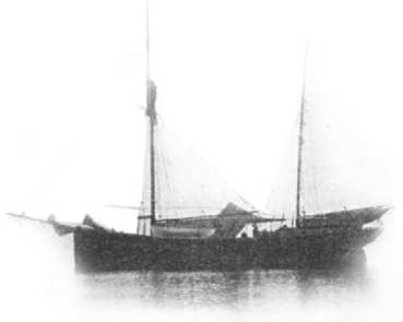
All the known details of the expedition to Spitsbergen described enough, and there is no need to repeat them. But one thing still deserves attention. Expedition for a three-month (return of the "Hercules"
in Arkhangelsk was scheduled for October) was completed a little over a month. Rusanov, didn’t make it a secret, that he planned to leave in August 15, Spitsbergen. He was in a hurry. It was already the middle of August, and the opportunity to move to the east as far as possible every day diminished. It is clear that he was looking at "a survey of Svalbard as a small first test."
Thus, to minimize the time spent on the archipelago, Rusanov headed forward Novaya Zemlya, simultaneously conducting hydrological studies the branches of the Gulf Stream in the Barents Sea. Taken by storm, "Hercules" had gone to the strait Matochkin.
From that moment begin the most mysterious and tragic part of the expedition of V. Rusanov. One small set of facts available to the researcher, could hardly contribute to the emergence of one plausible explanation for the fate of the expedition. It's been 100 years and we still have more questions than answers. And the only way to understand what happened, or rather, what might have happened to the crew of "Hercules", is to re-evaluate all the information that in some way have been connected with it. This is the case when the need for careful consideration of known data can be an important new search.
The first and the main mystery of the story was the text of the telegram, left by the head of the expedition in the Samoyed encampment in Matochkina Bowl before the leaving of the ship to the sea. Here is the complete text to the original spelling: "The telegram of the leader of the expedition in 1912, V.A. Rusanov left on Novaya Zemlya, in the Samoyed’s colony – Matochkin Bowl in August 18 with a request to send it as an opportunity, to the following purpose: Petersburg Zhdanovka 9 Styunkel. The South of Spitsbergen, Island of Hope. Surrounded with ice «studying the hydrography of the Storm, we are souther than Matochkin Bowl. I went to the north-western tip of Novaya Zemlya from there to the east die if the ship was headed to the nearby islands on the way: Isolated, Novosibirskiy, Wrangel. We have reserves for the whole year. All are healthy. "
This last message made a lot of contradictions in the analysis of future plans in the missing expedition. There are a lot of interpretations of its meaning. The most common version was, that V.Rusanov mistakenly missed the excuse "not" before the word "die." That is to be understood "if the ship did not die, heading to the nearby islands on the way ...» Most likely, it was not so much trying to figure out how to justify the senseless intention of Rusanov. Especially since the stylistic evaluation phrases confirms the initial lack in the excuse of the building the entire proposal. L.L. Breytfus wrote: "Assuming that the V.A. Rusanov made a mistake and did not pay attention to the passage of the particle" not ", that is, assuming that he intended to go to the island is secluded and further to the east only, "If the ship does not die", and even then is not clear how one could decide to go to such a risky and requiring schee some time swimming with food reserve for one year »14.
At first reading, some misunderstanding appears, caused most likely by the fact that in a hurry V. Rusanov did not take care of properly constructing sentences. But if you carefully read the message, the meaning is clear and it does not have absolutely any contradictions. V. Rusanov meant only that moving to the east at high latitudes of the 78th parallel, the distance from shore, and the ship could be lost at any point in their journey from the Cape to the Bering Strait Desire. "... If the ship dies I will go forward to the nearest islands on the way ...". It should be understood that if a ship crushed ice somewhere in the Kara Sea, the expedition will travel to the island of Solitude, and if in the Laptev Sea, the meridians Siberian Islands, the natural way to salvation will be the islands, and, finally, in the Chukchi Sea - to Wrangel Island. Further to the east, with the Wrangel Island Rusanov already traced unhindered access to the Bering Strait. These few words "... on the way to nearby islands ..." contain a basis for understanding the meaning of the message. Rusanov accurately described his high-latitude route from Novaya Zemlya to the Bering Strait, not traditionally along the coast, and from it a considerable distance to the north of the above named islands (Pic. 4).
Thus, this way, which was written in the should be held above the northern end of Novaya Zemlya, along the 78th parallel, between the islands of Solitude and Wiese: "... I will go to the islands of Solitude ..."
(it is natural to go to the South after the sinking of the ship, and not to the North). The route crossed the unknown at the time the archipelago Severnaya Zemlya and out to the islands of De Long and to Cape
Dezhnev.
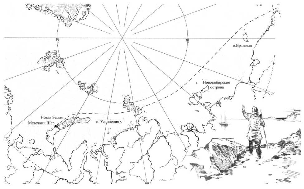
Рис. 4. The route of «Hercules», which was written in the telegram of V.Rusanov from 18 of august 1912
With the understanding of the meaning of written by V. Rusanov, comes the understanding that the more absurd solutions was difficult to make. Look at this as at a real intention of V.Rusanov means to name the expedition leader, as a perfect adventurer, or worse, as an absolutely stupid person in the Arctic shipping. Neither this nor that of Rusanov I can’t say, of course, it is impossible. Therefore, he never wanted to be misleading. Note did not have the affirmative and carried a well-defined plan of the expedition. Most likely, that he wanted to note a desire way of the expedition, which in the reality of which it is likely was at the question. It was written just in case. In case for some incredible set of circumstances high-latitude ice-hole will go far to the east.
***
The further route of the, "Hercules", continued to believe, laid to the northern tip of the island and in the early September, "Hercules" should enter into the waters of the Kara Sea. The expedition went for- ward to the coast of Siberia, which arrived safely in autumn 1912.
Developing this version, you can assume that to the beginning of September, "Hercules" went in the Kara Sea, before the north-west winds moved up the ice in the Barents Sea to the coast of Novaya Zemlya. This powerful ice massif subsequently intercepted the "Holy Foke" on the way to Franz Josef. Attempts of G. Sedov around the ice from the West didn’t help, and the expedition stood in the peninsula of Pank-ratieva in winter. The same winds could carry ice from the Kara Sea coast of Novaya Zemlya. In this situation, seeing the ice-free sea east of Cape Desire, and V. Rusanov and A.. Kuchin as planned went forward the island of solitude and tried to move in this direction at least to the edge of the ice. After going so in clear water to the displaced to the south-east of the North Kara ice massif, "Hercules" could get around it with the W and S and go to the mouth of the Yenisei River (picture 5). At present time, this is the route used when sustained winds of the northern rhumbs cover the southern straits of Zemlya by ice masses. The length of the journey from Cape Desire by course of 142 ° to the island Dixon is 250 miles.
Pic. 5. The route of «Hercules» around the Cape of Wishes in the autumn of 1912
This version can be taken as the main, if not the circumstances that allow us to propose other assumptions, some of which is not less likely.
The first thing to consider the possibility of wintering on the easten bank of Novaya Zemlya. In the literature, this scenario occurs quite often. There would be no doubt in this regard, if next year's expedition is found off the coast of Taimyr. Reserves, as reported by V. Rusanov, on board had only for one year, so to the beginning of navigation (July 1913) the provision was already over-end, and would have to rely only on the hunt, which is in the Arctic has always been the only additional power supply. In this situation, nobody would go to the east. Naturally it would be after a severe winter goes to Arkhangelsk, and not to the coast of Taimyr. More on Svalbard, R. Samoylovich didn’t agree with the optimism of Rusanov according the food supplies and sleep-suppressors. "The stock consisted of 2 or 3 barrels of cod and a few barrels of beef - recalled Rudolph Lazarevic - and a relatively small amount of any canned food. Were few and timber to build winter quarters. If we add to this that the fuel were only 60 tons of coal, it becomes clear how dangerous the expedition was wintering in the Arctic regions.15.
Deny the possibility of wintering in Novaya Zemlya and the materials of swimming of the steam schooner "Andromeda" in the summer of 1915, which managed to explore the northeast coast of the island of Cape Desire to Bay Currents. The captain of the vessel Pospelov, supervised-shy search expedition, said in the log only sign on Cape Vissenger-Goft posed G. Sedov during the winter voyages in 1913. Other signs of stay Rusanov expedition to the Kara side of Novaya Zemlya were observed.
This fact suggests that the "Hercules" was not at the northern tip of the island and the coast of Taimyr, he did not go around the Cape of Desire, and the Cape of Menshikov, ie Kara Gate Strait. And there is a reason for this.
Firstly, it seems doubtful the decision to go to the Kara Sea, not having any idea about the ice conditions. Quick changes of the winds directions and, as a consequence, ice seas always lead to the encirclement of the vessel with ice.
Secondly, Rusanov said it. In the "Features of the navigation in polar waters," the article "To the question about the Northern Sea Route to Siberia," he says with conviction that "in the Arctic waters can not be satisfied with the usual type of the construction of vessels," and sea links with the Siberian ports should be provided only icebreaking vessels. For all his enthusiastic nature he could remember in September 1910, when the danger of winter starvation loomed over the team of "Dmitriy Solunskiy." Small cutter "Hercules", which was in the icebound seas, was hardly suited to winter. Epic "Tegetgofa" in the same area of the Kara Sea would be here a small consolation. The captain A. Kuchin, knowing intent Rusanov, claimed that "thinks winter suffocate the whole expedition, but because he is the captain of the vessel, in any case, at a meeting with the polar ice will not dig into the ice ...".
There is another moment in the history, on which few people paid attention to justify the risk of Rusanov’s aspirations. The fact that on the board was a woman, the bride of the chief of the expedition, the French Jean Juliet Sossin, is known and illuminated enough, but in the context of the leader of the very dangerous the plans, this fact was not considered at all. Perhaps it could be a key to understanding the true intentions Rusanov. Inviting her on an expedition, he would hardly have admitted the possibility of longterm transition to hummocky ice of the open sea after the sinking of the ship, as he wrote in a telegram, aware that the man is prepared for the hardest thing, what really is there to say about a woman. Risk the life of his future wife, Rusanov would not have become. In her presence he want only glory.
His desire for the supremacy in the matter of the Northern Sea Route is also not in doubt. Output from St. Petersburg good equipment Lieutenant G. Brusilov expedition, set for the same goal, could greatly push for stronger action. Rusanov knew quite unpredictable voyage around the northern tip of Novaya Zemlya can end in the best case a repetition of 1910, and all the credit of Russian pioneer of the Northern Sea Route will go Brusilov.
And here would be appropriate to remember R.
Amundsen, who a year earlier, after knowing about the intention of R. Scott to conquer the South Pole, without the knowledge of the public began to prepare the expedition in order to get ahead of the Englishman. Parallel, which can be seen here, and the role in it A. Kuchin, could be a reasonable explanation for many. The captain of "Hercules" was a witness to a historic event September 9, 1911 in the roads of Funchal Madeira, Amundsen when the team announced his intention to go to the North Pole ... south. "This news struck all - A. Kuchin recorded in his diary. - No one suspected. Known only to himself Amundsen, Hiertsen, Nilsen and Prestrud. To me it made a bad impression. My first thought was the idea of parents: they are waiting at home. All my plans for the future again collapsed. But sadness soon passed. There was a drunk. New ideas, new plans, as far from the old, as the South Pole to the North ... I remembered the old Bjornson:
Raise your head, cheerful boy!
If you dream don’t come true – one, another, All the same –the new will sparkle!»16.
There is no doubt that Alexander Stepanovich shared his impressions with the Rusanov. And that, apparently, do not miss the opportunity to repeat a "great company."
Remembering the catch phrase "everybody loves a winner," Rusanov 31 (18) August left Matoch-kina Bowl cutter and sent not to the north, as indicated in the report, and to the south, ahead of Brusilov almost two weeks.
* * *
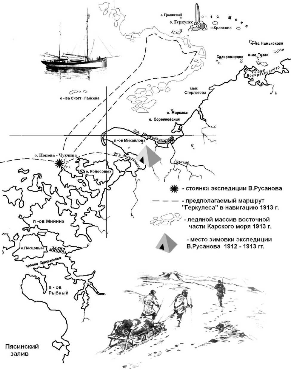
Anyway, at the end of September 1912 at the approach to the west coast of Taimyr "Hercules" met impassable ice and had to stand up for the winter. Multiple versions of the release of the expedition to the North Land and Rusanovs’s championship in the opening of this archipelago are so unlikely that it is not subject to serious consideration.
Second, if it occurred during the summer season of 1913, then, is all-doubt, as a pillar with the inscription "Gerkules. 1913 "was not in the center of the island Mona, and the newly opened archipelago.
We must not forget the heavy ice conditions, marked by meteorologists in the eastern part of the Kara Sea. This is confirmed by subsequent expedition’s materials.
August 22 (September 4), 1914, the barque "Eclipse", sent in the search of the expedition of Rusanov, left Dixon heading the east. The very next day, the islands of Scott Hansen, the vessel entered the solid ice field. With great difficulty, struggling narrow channels along the banks of Chariton Laptev, O. Sverdrup expedition, only 13 (26) September came to Cape Wild and got to hibernate near the Cape Shtel-linga. The expedition member, representative of the Russian Navy Department, Dr. Trzhemessky in its report pointed out that "for the time, in spite of strong winds from the south, the ice on the east was impassable ..." In the opinion of the Sverdrup, the ice age was two years.
* * *
Wintering place for "Hercules", apparently, was chosen bay at the south-west coast of the peninsula Mikhailov. Of the three currently known sites Rusanivska expedition is the most preferred place for wintering ship and unlike the island Popova-Chuhchina completely safe with strong shifting of the ice seas. Based on a set of objects left the expedition, on a high promontory (Cape conspicuous, now Cape Rusanov) was placed a small camp. But the main wintering area is likely to be a vessel.
A few years later, in 1921, the traces of the coastal camp will be the detected by the Party of Begichev N. and L. Jacobsen. The search party was organized at the request of the Norwegian government, was to look for traces of two Norwegians, the expedition R. Amundsen's ship "Maud", and P. Knutsen Tes-sema, who died in the fall of 1919 during the transition to Dixon.
Searchers walked along the shores of Cape Chariton Laptev Wild to Dixon. At the western edge of the Cape Peninsula, Mikhailova N. conspicuous Begichev found the remains of a fire, and there among the ashes and embers, as he reported in Komseverput, "lie charred human bones and a lot of buttons and buckles, nails and something else: the shot cartridge paper and several rounds of ammunition from the rifle. "Items found near the fire, were collected by Jacobsen and packaged for delivery to Norway. Head of the research department of the Committee of the Northern Sea Route in Sibrevkome engineer S. Rybin looked at them in detail and described in his report:
«1. "Copper bullets from rifles - 6 pieces, each height - 55 mm diameter outlet - 7 mm, the diameter of the lower end - 12 mm. Year of ammunition - 1912-th.
-
2. Coin, apparently, nickel, - the French. Diameter - 24 mm. On one side of the image with the bust of a woman with a laurel wreath on his head. Clearly understands the inscription: "FRANCAISE"; on the other side: "RTE 25 CENTIMES". Year of the coin – is 1903.
-
3. Tea spoon, on the back hardly understands the stigma: "ALPAGHA".
-
4. A copper holder of a hunting rifle, diameter - 17.5 mm, on the back of a brand: "H. UTENDOERFFER NORNBERG № 16 ".
-
5. Hunting cartridges, paper, very spoiled, on the back of a brand: "RWS 16-16 GASDICHT". Paper cartridges are charged and not to shoot, and copper - shoot (as well as all the rifle).
-
6. Copper residue pocket barometer diameter top - 48 mm, height of the box - 21 mm, covered with strong rust on the dial are easy to parse numbers 72-74-76, there are other signs, but it is illegible. On the front side and back side of a pretty clear mark in the circle 4 letters: "PIIBN".
-
7. Buttons from clothing, metal, on one of them quite clear stamp with the words: "PARIS SAMARITAINE"; diameter of the buttons - 16.5 mm, and the other of metal buttons, apparently, from the underwear brand has a clear: "KODAK".
-
8. Rusty remains of a pen knife with 2 blades.
-
9. Strongly rusty blade large knife.
-
10. Metal frame from one eye goggles or eyeglasses.
-
11. Large smoked glass from snow glasses-canned.
-
12. Different buckles and hooks from clothing, button from the boot. On one buckle (on trousers or jackets) brand: "PRIMA SOLID"; French safety pins, nails, small scraps of steel wire diameter 3.5 mm, length of individual scraps of centimeters to 5-6.
-
13. Piece of thick cotton cloth, black and white in a cage.
-
14. Piece of gum, apparently, from the points-of canned food.
-
15. Iron tip of the gaff length 24 cm
-
16. Iron thin strip - Vol sled runners "17.
Initially, these findings associated with the missing Norwegians, but when in 1934, the similar objects were found on the island Chuhchina - Popov, the question of their membership was revised. Historian, the polar explorer N.Y Bolotnikov, comparing findings with the findings Begichev N. Popov Chuhchina island, advanced version that the Cape was another conspicuous parking Rusanov expedition. Confirmed this version Urvantsev indicating shotgun cartridge, which, in his opinion, could not be at Knutsen and Tessema. Besides a variety of subjects indicates the duration of parking, which might not be the case with the Norwegians.
* * *
In the winter of 1912-1913 years for rusanovtsev, apparently took place without major incidents. The team worked on creating a camp and hunting. The restless head of the expedition, his bride and the captain of the vessel Kuchin make trips to survey of the surrounding islands. In the dark, the far raids were dangerous. When summer Rusanov and experienced hydrographer A. Kuchin passed to the east, along the Chariton Laptev. They were interested, above all, fast ice, which is not exposed in the past year. Its power and width can tell a lot about the possibility of the passage to Cape Chelyuskin.
How far to the east coast went the party of Rusanov, could clarify all the materials of the same expedition of Begichev-Jacobsen, which is in six kilometers from the northern tip of the Cape Sterlegov found another parking. Well known polar geologist, researcher Nicholas Taimyr Urvantsev wrote: "... Jacobsen found abandoned sled that looks quite similar to the ones that have Nganasans. They were similar to the sleds, which Jacobsen had seen in Norway. Kopylya, whivh were found the sleds were attached to the steel cable. Between Kopylov as spacers inserted curved copper tube, the tube has the same front between the upturned ends of the rails. Runners themselves are hit bottom thin iron plates. Near the sleds were visible the remains of the fire, but no other objects or its wreckages were not "18.
Of course, there are no confidence that the sleds were belonged to the expedition of Rusanov because they could still belong to the Norwegians from the schooner "Maude" and rescue mission of O. Sverdrup on the barge "Eclipse", wintered in 1914-1915, about 90 km east of Cape Sterlegov.
Summer of 1913. The long-awaited time of the Arctic navigation came. We can assume that the "Hercules" with the first ice-free coastal of channels of the bay Mikhailov went to one of the northern islands of the archipelago Minin, who was later called Popova-Chuhchina (Pic. 6).
N.Urvantsev, reminding his trips in the Skerries of Minin, wrote that at the beginning of August in the Gulf of Pyasinskaya, ice has already gone, "... in the straits he was loose, broken, and off the coast of pure water, so that you can still sneak it" 19.
According the variety of items found on the island of the hydrographic expedition in 1934, we can assume that there was deployed a second long camp and unloaded from the ship a significant amount of equipment. Apparently, this was done to reduce the settlement or in the event of loss of the ship at the time of the research voyage to the east, along the edge of the ice. There is a big possibility,that Rusanov in August 1913 still tried to get around the ice to the north. Of course, his desire was doomed to fail. Ice brought by westerly winds, created a very heavy ice conditions in the eastern part of the Kara Sea. Navigation of the Northern Sea Route was interrupted for two years. Fast ice west coast of Severnaya Zemlya archipelago, connecting to the mainland shore ice, completely shut out in the Laptev Sea. This is confirmed by the materials of the expedition B. Vilkitsky.
In late August 1913, the icebreaking ships "Taimyr" and "Vaigach" from the east came to Cape Chelyuskin. The ice was so powerful that it could not pass the breakers to the west in the Kara Sea. Trying to get around the ice to the north, the expedition discovered the unknown land. It was the last of Discovery. Large Arctic Archipelago that separates the Kara Sea from the Laptev Sea, has been named Earth Nicholas II (now the Northern Land). Icebreakers are passed along the east coast and back to Vladivostok. The west coast of the archipelago was tightly closed by ice, and the newly designated Strait, named after the chief of the expedition Strait Vilkitsky not opened and the following year. "Taimyr" and "Vaigach" after a severe winter 1914-1915 period at the eastern coast of Taimyr managed to break into the Kara Sea in the summer of 1915.
At the same time, when the newly opened archipelago solemnly established the national flag of Russia, "Hercules" was moving towards the east, then the north, exploring the location of the ice. Short of a few miles to the islands of Mona, the vessel near the ice edge was anchored. Most likely, there was decided to urgently go to the west.
-2$t.
IS о. Колосовых n -OB Минина
Рыбный
SocxPeCX^
п -ов Михайлова ^х,.
о - о.Кравкова
Q^ea Каминского о - ва Скоп - Гансена о. Попова - Чухчина,
^|^ - стоянка экспедиции В.Русанова
- место зимовки экспедиции В.Русанова 1912-1913 гг.
-ледяной массив восточной части Карского моря 1913 г.
- предполагаемый маршрут "Геркулеса" в навигацию 1913 г.
МЫС
Стерлегова о. Гранитный о. Геркулес о. Марка on о. Соревнования у о-ва Тилло
Североморцев
^ 8
° М
Пясинский залив
Pic. 6. The western coast of Taymir. Shers of Minin
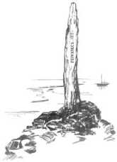
Rusanov on foot went to the islands for the last of the geological survey and the installation plaque. Made before in this case the post with a neatly carved inscription "HERCULES. 1913 ", which marked the easternmost point of the route of the ship and unfulfilled dreams leader of the expedition, was installed in the center of Mona Island, the island Veyzelya (now Hercules). After 21 years this column, broken sled on which he was brought to the island, and zinc box of ammunition were discovered Soviet hydrographer A.
Gusev. Doubt that the column was brought to the island from the ship, not a lot. One can see that the letters are cut cleanly and without any haste. Such work can only be done during the winter or a long voyage. After the death of "Hercules" in the frozen tent to do it nobody would, especially haul heavy column for many miles to the island.
At the end of August in 1913 "Hercules" headed to the west to the abandoned camp. By the time the northerly winds could score approaches to the islands and all that was found on the island, we would have to drag through the hummocks on the ship manually. In this case, the evacuation would be carried out in an emergency mode, and many things would stay there.
The things of Popov and Chuhchina were found later on the island, and they tell us about the possibility of the death of the sailors during the winter. Put away with many other things, they have been forgotten in a hurry or simply lost, covered in snow.
Such emergency evacuation of the people, who wintered is not uncommon in the Arctic. Known polar hydrologist writer V. Vasnetsov, recalling the sinking "Politotdelets" near the coast of Kolguev in 1937, wrote: "... people have repeatedly tried to withdraw from the island. To send a boat to the shore prevented the incessant surf. Finally turned out to be a good day, the boat came, and the people sat up around on the lonely shore, exhausted long wait, afraid to miss a moment, and hurried, leaving everything behind, to get to the ship. Our expedition was equipped with a fairly modest, a lot of that here has been abandoned, we could only dream of"20.
* * *
From this point "Hercules" began a race against time. Everyone understood that spent most of the short Arctic navigation and procrastination will not get out of the Kara Sea. The second winter on the coast would be tantamount to death.
The further fate of the expedition is very similar to many tragedies in the Arctic, and depended on the time of return. Based on some of the findings made at different times, there is much speculation about the last route "Hercules" and the fate of its crew.
The place of the tragedy, according to one of the versions, is the mouth of the river Pyasina. Went through the narrow, ice-clogged straits archipelago in the sheres of Minin, "Hercules" could run aground, and the team, leaving the ship, went on boats in the inland. This assumption arose in 1974, when an expedition of "Komsomolskaya Pravda" on the western coast of the island in the archipelago P of the island Pestsoviy Minin from the bottom of the Strait of Deep was raised many ship parts and small pieces of skin vessel expert evaluation is possible to conclude that the representation of the object could belong to a ship expedition Rusanov. A close look at this version, it begs the question: what to the vessel took wade unfamiliar pilotage in respect straits Minina Skerries Pyasina to the mouth? "Hercules", if by that time he was alive, most likely would have gone to sea heading west, especially since the coastal fast ice formed much earlier than ice seas. Urvantsev, describing his work in the eastern part of the archipelago of Minin, recalled one occasion when, in early September, with the northern winds blow cold and the bay, where there was their motor boat, frozen. "Now I had to leave immediately - he wrote. - We are on the Gulf Pyasinskaya approximately hundreds of kilometers. Have to go out to sea, along the edge of the archipelago, where the excitement will not be formed at once continuous cover, and will only "pancake" ice "»21.
Rusanovtsy could go to the mouth of the river Pyasina only if the "Hercules" sank or was iced to the north from the shers of Minin. This version is considered by the researchers to be the most likely, but it is doubtful that still have not found the remains of men, their equipment and boats on which they were going to Pyasina, and possibly up to her. All these significant evidence could not disappear without a trace. Appropriate here to recall the tragic story of the expeditions of De Long and Andrew, who were found in very remote areas, where the presence of people - a perfect rare.
At the same time, at the mouth of Pyasina in the exit to the sea, was a large fishing village of the Cape Vhodnoi, the sites were scattered along the coast and in the river Pyasina. On each such site worked for about ten people.
Thus, the long-term work in the sphere of geological parties, which examined in details all the islands and skerries of Minin and Pyasinskiy Bay, gives the opportunity to make a disappointing conclusion -last Rusanovskaya parking hardly associated with these places.
The expedition of "Komsomolskaya Pravda" in the 70's and most recently works of the prospecting enthusiasts of the city Oryol. It didn’t give the optimism.
Following a review of the possible search area becomes Yenisei Bay and the mouth of the Yenisei. "Hercules" could go to the nearest settlement or to the places Golchikha and Megevoe, which were was located at the time on the left and right banks of the Yenisei Gulf. Rusanov not once mention the settle- ments in their articles as future first Siberian ports. In the difficult situation for the expedition, it would be the most sensible way to salvation. In another set of circumstances "Hercules" could go to the Obskaya gu-ba and Baidarskiy bay.
In the research work of the famous polar explorer, Doctor of Historical Sciences M.I. Belov, who believed that on the way back "Hercules" could reach the south-western part of the Kara Sea, referred to the report of Captain icebreaker "Nightingale Budimirovich" Messer in 1919, where he wrote that between the island Beliy and Ugorskiy Shar, on the 72 ° 24 'north latitude and 65 ° east was seen "capsized boat... From the ship was found only tank and bottom.
Thus, the expedition ship of V. Rusanov in the autumn of 1913, moving to the west could be icebound, with equal probability in any of the meridians of the archipelago to Minin Ugra Bowl. The team, in this case, leaving the ship, moved to the boats to the mainland. Survive in the desert shores of the Kara Sea, away from populated areas would be almost impossible.
Finds, which were marked by Belov, it is good for the version that is not in the literature. If we take into account the possibility of sailing "Hercules" around the Cape of Desire to the Siberian coast in the autumn of 1912, why not assume that Rusanov, the favorable outcome of wintering, tried to return by the same route? According to the scheme described in the article "To the question about the Northern Sea Route to Siberia", a piece of which was found on Popov Island-Chuhchina, Rusanov the alleged existence of ice-free water at the site of the Ob and Yenisei flow of the Kara Sea, which in his opinion, is the warm water directly to Cape Desire. In this case, the "Hercules" can exactly replicate the epic "St. Anna" and disappear without a trace in the icy expanses of the Arctic.
In conclusion, it should be noted that the version of the last days of the expedition of Rusanov can be very much, but, unfortunately, none of them has sufficient grounds for serious consideration. This is the case when only the new findings will make it possible to move forward. In the meantime, one thing remains - is to search.
Reviewer - Palmin Viktor Andreevich, PhD in History, Associate professor.
