Comparative Analysis of Soil Hydrothermal Parameters in Natural Ecosystems as Influenced by Vegetation Cover Density

Author: Abbasova R., Alizade N., Rehimova Z.
Journal: Бюллетень науки и практики @bulletennauki
Section: Естественные науки
Article in issue: 5 т.12, 2026.
Free access
This study systematically investigates the formation of hydrothermal potential in natural cenosis of mountain brown-gray soils on the southeastern slopes of the Lesser Caucasus, considering vegetation cover density. The aim is to identify patterns of temperature and moisture reserve variations under different vegetation densities and to reveal structural characteristics of hydrothermal potential. Comparative analysis at the cenosis level demonstrated a functional relationship between vegetation cover density and hydrothermal parameters. The results indicate that vegetation density is a key regulatory factor in the formation of hydrothermal potential, providing important insights for assessing water–thermal resources and predicting ecological processes in mountain ecosystems.
Lesser Caucasus, mountain gray-brown soils, hydrothermal potential, natural cenosis, vegetation cover
Short address: https://sciup.org/14135626
IDR: 14135626 | UDC: 552.21:631.4. | DOI: 10.33619/2414-2948/126/11
Сравнение гидротермических показателей почв естественных ценозов в зависимости от плотности растительного покрова
Изучены особенности формирования гидротермического потенциала в естественных ценозах горных серо-коричневых почв юго-восточного склона Малого Кавказа с учетом плотности растительного покрова. Цель исследования – определить закономерности изменения температурных и влажностных запасов при различной плотности растительности и выявить структурные особенности гидротермического потенциала. Сравнительный анализ показателей на уровне ценоза выявил функциональную зависимость между плотностью растительного покрова и гидротермическими параметрами. Результаты демонстрируют, что плотность растительности является ключевым фактором, регулирующим формирование гидротермического потенциала, что важно для оценки водно-термических ресурсов и прогнозирования экологических процессов в горных экосистемах.
Text of the scientific article Comparative Analysis of Soil Hydrothermal Parameters in Natural Ecosystems as Influenced by Vegetation Cover Density
Бюллетень науки и практики / Bulletin of Science and Practice
The complexity of Azerbaijan's physical and geographical structure and climatic variations, particularly on the southeastern slopes of the Lesser Caucasus, creates conditions for the formation of unique relationships between soil, vegetation, and hydrothermal conditions. In this region, vegetation distribution depends on the interaction of relief, climate, and soil factors and is characterized by the richness of Azerbaijan's flora [1, 2].
Hydrothermal conditions—temperature and moisture reserves — are considered the primary ecological factors determining the density and structure of plant cover, as soil and air temperature, along with soil moisture, directly influence photosynthesis, root systems, and plant physiology [3].
Various ecological studies have shown that high hydrothermal potential promotes the development of forests and dense meadow communities, while low temperatures and humidity stimulate the proliferation of rarer xerophytic species. The hydrothermal regime, along with soil moisture supply and thermal balance, directly influences the dynamics of soil processes such as humus formation, mineralization, leaching, and sorption [4-7].
During periods of high humidity, the processes of decomposition and transformation of organic matter in the soil profile are activated, while during dry periods, stable forms of humus are formed. In areas with low annual precipitation and high evaporation, such as the Agdere region, the influence of these factors on the soil is particularly pronounced [8].
Mountain gray-brown soils, common on the southeastern slopes of the Lesser Caucasus, are among the primary soil types characteristic of the region's natural and geographical conditions. They form in the middle mountain zone and the transition zone between semi-desert-steppe and mountain meadow vegetation. Their morphological and physicochemical properties—including humus content, mineral composition, and moisture capacity—are shaped by the combined influence of topography, climate, and hydrothermal conditions, directly affecting the density and structure of the vegetation cover [9, 10].
The decisive role of temperature and humidity in the formation of soil factors is recognized as one of the fundamental tenets of classical soil theory. V.V. Dokuchaev characterized soil as "a natural-historical body formed as a result of the interaction of climate, living organisms, relief, parent rock, and time," emphasizing the special role of heat and moisture among these factors [11].
K. D. Glinka and his followers demonstrated that the physical properties of soil, especially density and moisture capacity, are closely linked to climate, heat, and water balance [12].
In this context, the density of meadow vegetation in mountain gray-brown soils acts as a natural indicator of hydrothermal potential. Due to the variability of soil water and heat balance, seasonal precipitation patterns, and high temperature ranges, the density of herbaceous plants in meadow communities is considered an indicator of hydrothermal conditions. Changes in soil moisture and heat regimes directly influence plant biomass formation and canopy density, which is one of the main criteria for assessing hydrothermal potential [13].
The aim of this study is to identify the characteristics of hydrothermal potential in natural meadow communities developing on mountain gray-brown soils on the southeastern slope of the Lesser Caucasus, based on vegetation density. This approach allows for the scientific substantiation of soil-vegetation-climate interactions at the regional level and has implications for landscape ecological research.
Research object and method
The study area is located on the southeastern slope of the Lesser Caucasus, near the village of Talysh in the Aghdere district of the Republic of Azerbaijan. The coordinates of the study area are 40°21′55″ N and 46°55′08″ E, with an elevation of approximately 246 meters above sea level, situated within a flat area.
The Aghdere district is part of the Karabakh economic region, which encompasses the southeastern slope of the Lesser Caucasus and is characterized by unique natural and climatic conditions (Figure).
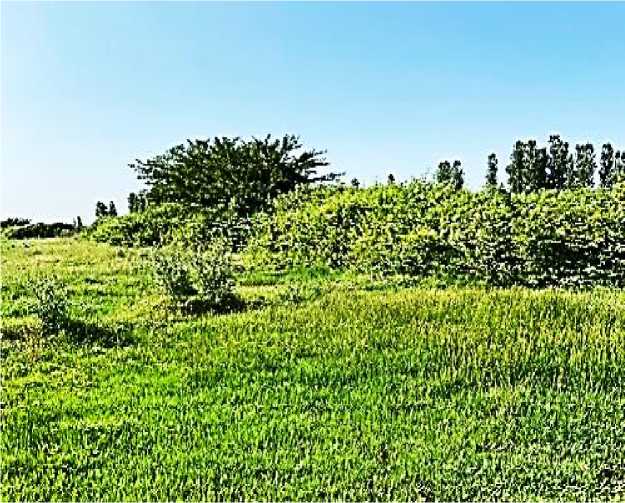
Figure. General view of the study area
The Agdere district is characterized by a moderately warm climate with dry winters and belongs to the semi-desert dry-steppe climate zone. The average annual air temperature and precipitation are 13.9°C and 363 mm, respectively. The total moisture coefficient (Ku) varies between 0.3 and 0.5, and the total solar radiation is 124–128 kcal/cm² [14].
The soils of the experimental site are mountainous gray-brown and have a heavy clay texture. Particle size distribution correlates directly with soil density. Studies have shown that soil density ranges from 1.21 to 1.38 g/cm³. Density is lower in the upper horizons but increases steadily along the profile (Table 1).
|
Table 1 DENSITY INDICATORS OF MOUNTAIN GRAY-BROWN SOILS UNDER NATURAL CENOSES |
|
|
Soil type |
Horizon, см Soil density, g/см³ Average density by profile, g/см³ |
|
Mountain gray-brown |
0-5 1.21 5-10 1.25 10-15 1.28 1,29 15-20 1.34 20-25 1.38 |
The results of numerous replicated studies show that the average bulk density of the soil is 1.29 g/cm³. The research methodology is based on the determination and comparative analysis of the hydrothermal potential (HTP) of soil environments located under natural cenoses. HTP was determined according to the methodology proposed by N.R. Suleimanov. The distribution of soil temperature and moisture by depth was studied in the field, and hydrothermal potential calculations were performed in triplicate. To assess the hydrothermal potential parameters formed under the influence of specific abiotic factors in existing climatic conditions, N.R. Suleimanov's hydrothermal potential index was used. According to this method, under the influence of external climatic factors, the potential soil temperature and its degree of moisture are combined into a hydrothermal potential parameter, which allows for the determination of boundary conditions and the characterization of the hydrothermal state of the soil environment [15, 16].
Soil temperature and moisture were measured directly in the field using a modern, multifunctional, mobile EC-350 device (made in the USA), which operates on the "soil moment" principle. The soil reaction was recorded using a KCB-300 device. For this purpose, an experiment was conducted in a natural landscape on the southeastern slope of the Lesser Caucasus, in a flat area with mountainous gray-brown soils.
Interpretation of research results
The influence of the thermal and moisture regimes of soil on its physical state has been systematically studied in Russian soil science since the early 20th century. A.A. Rode, analyzing the formation of the soil water regime, demonstrated that the degree of soil moisture directly influences the density, air regime, and biological activity of the soil [17, 18].
This approach provides an important theoretical basis for explaining the relationship between the density of vegetation in meadow soils and hydrothermal conditions. N. A. Kachinsky, in his studies of soil physical mechanics, assessed soil density as an integral indicator of soil structure and its hydrothermal state. These concepts were further developed in studies of physical processes in soil, where the balance of heat and moisture plays a key role in assessing the functional state of ecosystems [19].
These theoretical views form the scientific basis for assessing the hydrothermal potential in meadow communities on mountain gray-brown soils based on the density of the grass cover (Table 2).
Table 2
SOIL HYDROTHERMAL POTENTIAL INDICATORS DETERMINED BY VEGETATION DENSITY IN NATURAL ECOSYSTEMS
|
Section |
Depth, sm |
Soil T, oC |
Soil moisture, % |
Water content, mm |
HTP, snr |
K st |
|
K-1 |
5 |
34.50 |
2,00 |
1,21 |
42 |
0,04 |
|
(sparse |
10 |
32.70 |
2,30 |
1,44 |
47 |
0,04 |
|
vegetation) |
15 |
31.50 |
20,10 |
12,86 |
405 |
0,4 |
|
20 |
30.50 |
55,30 |
37,05 |
1130 |
1,2 |
|
|
25 |
28.70 |
80,20 |
55,34 |
1588 |
1,9 |
|
|
0-25 см |
31.58 |
31.98 |
21.58 |
642 |
0.7 |
|
|
K-2 |
5 |
33,40 |
14,10 |
8,53 |
285 |
0,3 |
|
(dense |
10 |
30,90 |
46,40 |
29,00 |
896 |
0,9 |
|
vegetation) |
15 |
28,60 |
79,60 |
50,94 |
1457 |
1,8 |
|
20 |
27,40 |
86,50 |
57,96 |
1588 |
2,1 |
|
|
25 |
26,40 |
78,20 |
53,96 |
1424 |
2,0 |
|
|
0-25 см |
29,34 |
60,96 |
40,08 |
1130 |
1,4 |
|
|
K-3 |
5 |
34,40 |
1,80 |
1,09 |
37 |
0,03 |
|
(without |
10 |
34,60 |
3,20 |
2,00 |
69 |
0,1 |
|
vegetation) |
15 |
34,40 |
28,50 |
18,24 |
627 |
0,5 |
|
20 |
33,30 |
51,50 |
34,51 |
1149 |
1,0 |
|
|
25 |
32,10 |
72,50 |
50,03 |
1606 |
1,6 |
|
|
0-25 см |
33,76 |
31,50 |
21,17 |
698 |
0.6 |
Research in the natural ecosystems of a piedmont plain demonstrates that vegetation density is a key factor in shaping the hydrothermal potential of the soil. Soil temperature, moisture, water storage, and hydrothermal parameters (HTP – hydrothermal potential, Kst – structural coefficient of hydrothermal potential) were determined for profiles K-1 (sparse vegetation), K-2 (dense vegetation), and K-3 (no vegetation). Observations indicate that dense vegetation reduces surface temperatures and ensures their stability, while promoting a more uniform moisture distribution within the soil profile. As a result, profiles with dense vegetation are characterized by higher values of hydrothermal potential and its structural coefficient, while areas with sparse and bare vegetation demonstrate relatively low values. These results confirm that vegetation density serves as a natural indicator of hydrothermal potential and plays a key role in assessing the interactions between soil, vegetation, and climate. In profile K-1, surface moisture is minimal (6.9%) but increases rapidly with depth, reaching 81.96% at 25 cm, which is explained by a partial reduction in evaporation due to the grass cover. In profile K-2, surface moisture is low (4.3%) but increases rapidly starting from 10 cm, reaching 88% at a depth of 25 cm, demonstrating increased soil moisture retention under dense vegetation. In profile K-3, surface moisture is higher (17.4%), but at a depth of 15–25 cm, it reaches a level comparable to other plots — around 88%.
Surface temperatures are highest in K-1 (37.6°C) and decrease to 27.3°C with depth. In K-2, temperatures peak at 10 cm (34.7°C) and then decrease due to the microclimatic effect of dense vegetation. In K-3, temperatures are relatively stable and lower, with the surface warming to 30.3°C due to direct radiative energy transfer to the soil. These indicators are important for efficient soil use and the planning of agricultural activities.
In dense vegetation, the hydrothermal potential (HTP) ranges from 78 to 1590 snr; in sparse vegetation, it ranges from 150 to 1453 snr; and in bare areas, it ranges from 306 to 1630 snr. The average HTP values were 1111, 1273, and 1211 snr, respectively.
In natural ecosystems, HTP values are characterized by constant fluctuations, which are explained by the self-regulating capacity and structural stability of the soil. In sparse and bare areas, HTP decreases sharply, leading to weakened water retention in the soil profile, increased evaporation, and, consequently, more rapid changes in the soil environment.
A comparative analysis of hydrothermal potential values based on vegetation in natural ecosystems shows that the hydrothermal potential of the soil environment is primarily sensitive to vegetation density.
Conclusions
-
1. In the natural cenoses of mountain gray-brown soils in the Agdere region, the hydrothermal potential of the soil environment was determined by taking into account the density of vegetation cover and soil horizons, and a comparative analysis was conducted.
-
2. Hydrothermal potential (HTP) values varied from 78 to 1590 snr with dense vegetation, from 150 to 1453 snr with sparse vegetation, and from 306 to 1630 snr in bare areas. The weighted average HTP values were 1111, 1273, and 1211 snr, respectively.
-
3. Vegetation cover plays an important role in maintaining the stability of the soil microclimate.
