Антропогенная трансформация природной среды @atps-psu
Статьи журнала - Антропогенная трансформация природной среды
Все статьи: 285
A sub-bottom profiler survey on the Sirio lake
Статья научная
In the present article, through an integrated geophysical and geological study, we intend to determine the thickness of sediments deposited on the bottom of Lake Sirio (Ivrea - TURIN), through geophysical surveys carried out with a Subbottom Profiler (Seismic Sediment Profiler). This survey was also carried out in order to highlight any geological discontinuity, which may possibly indicate an interaction between the waters of the lake in question and sub-river sources that feed the lake itself, since superficially it does not have tributaries. In addition to the geophysical surveys, measurements of electrical conductivity and water temperature of the lake were performed in order to find a variation of these parameters, which could indicate the presence of a recharge area of the reservoir by underground sources. In the first part of the elaboration, the geology of the area in question is introduced, based on authoritative studies conducted in the past, relative to the geology of the complex called the Morainian Amphitheater of Ivrea (following, MAI). Subsequently, the discussion continues with the analysis of geophysical data for the estimation of the sediment thickness of the bottom of the basin, trying to correlate the results obtained by the seismic profiler, with some results of studies previously carried out on the Sirio or on geologically lakes. analogues, belonging to the same morainic amphitheater.
Бесплатно
Analysis of the Chervaz landslide
Статья научная
The purpose of this article is to make a critical analysis of the landslide Chervaz.The studies related to this landslide began after the flood of October 2000, following which in Aosta Valley they were activated and reactivated several landslides including the paleo-landslide of Chervaz. Despite being a paleo-landslide from the analysis of historical events it was not possible to collect any data on the triggering conditions of the landslide. From 2010 they were carried out several investigations to better understand the geometry and the dynamics of this phenomenon. As regard the future, new surveys are planned, in particular new drillings and geophysical surveys which together with the new information that can be derived from the multi - parametric probe DSM will allow to expand knowledge on this complex landslide.
Бесплатно
Статья научная
In this report will be reconstructed the piezometry of an area interested by a landfill of Urban Solids Waste (USW) and will be treated the most common techniques to protect the soil and aquifers from the pollution of the waste leachate.
Бесплатно
Anthropogenic transformation of forest ecosystems by geochemical and photosynthetic parameters
Статья научная
Geochemical and physiological indices gained at the background area and at the area under anthropogenic impact were compared. The study sites comprise 30 sample areas each. Overall, 600 samples of pine needles were designated for the delayed chlorophyll fluorescence measurement as well as 60 samples of soil and pine needle correspondingly were selected to perform the geochemical analysis. The biological uptake of the pine urban ecosystems is represented in the range: Mn (10,16) > P (7,19) > Ag (2,78) > Ba (2,76) > Cu (2,31) > Sr (1,85) > Ni (1,80) > Zn (1,75) > Pb (0,86) > Co (0,48) > Cr (0,40) > Zr (0,37) > V (0,36) > Ga (0,33) > Ti (0,21). In comparison with the background site data the biological uptake is increased in regard to V, Ti, Ni, Cu, Cr. The methodology implies the method of recording the relative index of delayed fluorescence with the help of fluorimeter “Photon 10”. The data accumulated in the course of the geochemical analysis allowed to distinguish common geochemical features of the study sites and revealed differences in soil and needle qualities. The value of relative index of delayed fluorescence (RIDF) under the impact of considerable anthropogenic impact is lower by 25% and more related to the background site. This deviation testifies that the human impact is present even on the early stage of ecosystem degradation.
Бесплатно
Astragalus kungurensis Boriss на ООПТ "Черниковский бор" (Пермский край)
Статья научная
В сообщении рассматриваются единственная популяция эндемика уральской флоры Astragalus kungurensis, встречающиеся на особо охраняемой природной территории «Черниковский бор» в Кунгурском районе Пермского края. Дается их характеристика, динамика, оценка состояния. Рассматриваются мероприятия по сохранению вида.
Бесплатно
Bioenergy and bioproducts from agro-wastes and wastewater, some potential processes
Статья научная
The following article shows some potential solutions for the valorization of wastes and wastewater produced by farms and food industries. It moreover introduces the need of green energy to reduce dependency on fossil fuels.
Бесплатно
Bioengineering techniques to prevent soil erosion
Статья научная
The paper illustrates the main bioengineering intervention techniques to prevent soil erosion describing for each of them the advantages, disadvantages, the applicative limits and the constructional errors.
Бесплатно
Estimate of air quality in valleys of Yegoshikha river and Danilikha river
Статья научная
The quality of air is the main issue that humankind faces every day. It is an essential aspect of health of the population. The objectives of this research are to determine what pollutants are the most significant and what sources of pollution are the greatest emitter in Perm. Data for this study comes from national net of measurements of air pollution of Rosgridromet and researches of air quality in different areas of Perm. There has been quantitative analysis of results of measurements that was hold close to valleys of minor rivers Danilikha and Yegoshikha in this study since 2016 to 2022. Air quality was estimated by comparing measurements of concentration of chemical substances with established hygienic standards. The analyzed data show that the main pollutants in air of Perm are Formaldehyde, Nitrogen Dioxide, Phenol and Ethylbenzene. Exceedances of maximum one-time concentrations of all significant pollutants were identified. Exceedances of daily mean concentrations of formaldehyde were observed during all the period of study. A possible explanation for presence of pollutants might be that burning of fossil fuels by transport and by fuel power industry, by impact of mechanical engineering plants. The results of this study indicate that the national net of measurements is non-effective and does not give enough information for estimation of air quality in Perm. We need to measure more pollutants, and to have more monitoring sites to determine the air quality and the impact of transport or industry or other sources of air pollution on human health.
Бесплатно
Статья научная
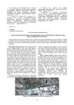
This study aims to analyze the Fersina stream in Pergine Val-Sugana and identify the river flow index to evaluate the present state of the watercourse and the possibility of intervening with river re-naturalization operations and On the shores. The section is located between the bridge of the SP66 and the bridge of Viale Dante Alighieri of Pergine Valsugana.
Бесплатно
Hydrogeochemical study on the cave of Bossea (Cuneo, Piedmont, Italy)
Статья научная
In article discusses the hidrogeochemical study of the cave of Bossea in Cuneo, Piedmont, Italy.
Бесплатно
Статья научная
The paper illustrates the remedial actions for the environmental reclamation of industrial site for a case of national interest. A series of assessments about the management of the muck and surface water regulation also have been carried out.
Бесплатно
Modeling of soil erosion by water in the provinces of Sikasso and Koulikoro (Republic of Mali)
Статья научная
Soil along water is arguably the most precious resource on the planet. In addition to its economic benefits, soil provides critical biological services [7]. Despite its pillar functions for society, soil is often overlooked and thus is subjected to degradation and erosion. Soil erosion represents a serious global threat to land, freshwater, and oceans [3]. In Western Africa, erosion is perceived as a critical threat to the livelihoods of millions of people. This study attempts to assess and map the potential annual soil loss in the provinces of Sikasso and Koulikoro (republic of Mali). Spatial modeling of soil loss by rainfall for the year 2018 was provided using rainfall data derived from the European Joint Research Center, the Soil Map of the World (FAO), digital elevation model (SRTM), vegetation activity (MODIS / Terra). Methods of calculation were based on the Remote Sensing and the Revised Universal Soil Loss Equation (RUSLE). The Geoinformation processing of the RUSLE subcomponents involved the use of the LS-factor algorithm of the System for Automated Geoscientific Analyses (SAGA) and the Raster calculator of the ArcGIS tool box. The potential soil loss within the area ranged from 0.02 ton/ha/year to 98.87 tons/ha/year with a mean of 1.63 ton/ha/year. The spatial pattern of the erosion showed a rate of 0.02 to 1 ton/ha/year for 39% of the territory, 1 to 3 tons/ha/year for 47.58%, while 0.01% experienced a rate of more than 50 tons/ha/year. This study despite its match with the result of the global soil loss by water established by Borreli et al (2020) [3], needs to be verified by direct measurements.
Бесплатно
Palynological approach to the history of the Kungur forest-steppe: goals and first results
Статья научная
Palynological studies provide a scientific basis for understanding of the development of the landscapes and vegetation. This approach has a special interest in understanding of the formation and dynamic of the Kungur forest-steppe, which history is still a topic of the discussions. Unfortunately, the western slopes of the Urals and the pre-Ural are yet studied very sketchy in terms of palaeoecology with only two palynological studies of Genkel (1953) and Golubeva (1956) of low-resolution and without any radiocarbon dates. In this talk, I will present the first results of the project dedicated to the understanding of the Kungur forest-steppe dynamics.
Бесплатно
Статья научная
This report constitutes a preliminary hydraulic study of the river Po in the urban area of Turin, particularly in the section between the confluence with the stream Sangone and the confluence with the river Dora Riparia. The purpose of the study is to model from the point of view of the hydraulic behavior of the river, by making use of geometrical data relating to river sections and hydrological information about Po basin. The analysis has been supported by use of the hydraulic modeling software HEC-RAS (Hydrologic Engineering Center - River Analysis System), a very used software in the application field of hydraulic engineering, which allowed to simulate the behavior of the river in its schemes characteristic of flow rate, and numerically to derive the physical variables that determine the hydraulic phenomena and of transport of matter.
Бесплатно
Статья научная
The aim of this report is to argue the preliminary study for the characterization of the aquifer located in the urban area in Turin. In particularly the site is positioned near Palazzina di Caccia of Stupinigi. In this article, it will be described which materials and methods are needed to carry out a slug test in field. Then it will be proposed which procedures should be done for the interpretation of the data collected during tests to estimate hydrodynamic parameters of the aquifer, like hydraulic conductivity or specific storage. It's important to point out that in this study it has been used the software called AQTESOLV, developed by HydroSOLVE. This is a software for the design and analysis of aquifer tests in confined, leaky, unconfined and fractured aquifers.
Бесплатно
Project for a drainage system for rainwater
Статья научная
In article about the project for a drainage system for rainwater.
Бесплатно
Soil properties of Hachijo-Kojima island in concern of self-sustenance in a remote island
Статья научная
The paper presents the result of the soil survey in Hachijo-Kijima Island from the self-sustenance point of view. In 1969, all citizen abandoned the Island. Traditional land use had not effected on the withdrawal, but social reason including the increasing of cash income might trigger on the abundance.
Бесплатно
Study on the rockslide of the Nibbio's valley (VB)
Статья научная
This work of thesis is focused on the study of the rockslide that happened on the 19 April 2005 in the valley of the river Nibbio, within the municipal territory of Verbania situated at the top of the region Piedmont in Italy.
Бесплатно

